Refugio in Refugio County, Texas — The American South (West South Central)
Amon B. King
Photographed by Mansfieldphoto.com, September 26, 2025
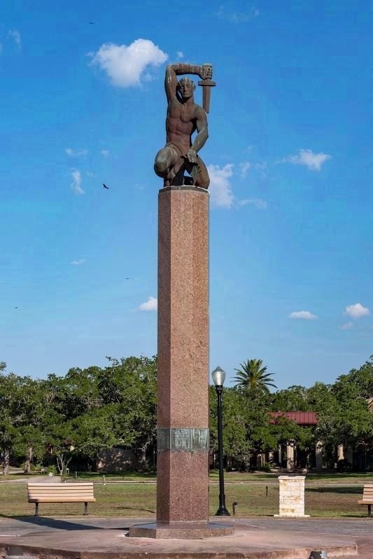
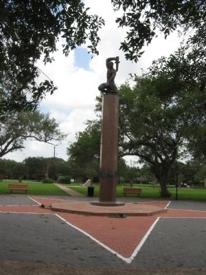
1. Amon B. King statue and Marker
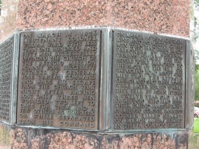
On March 14, 1836, Lieutenant Colonel William Ward with less than one hundred and fifty men successfully defended the Church of the Refugio mission against four successive attacks by General Jose Urrea's command and made his escape from the church that night after having lost only three men wounded, two left to care for them and a few others as couriers or while separated from command.
On March 16, 1836, Captain King and fourteen of his men who had been made prisoners by General Urrea's cavalry the day left before were marched to the slope of the hill on Goliad road about one mile from the Refugio church and shot. Their bones were later buried where they fell by John Hynes, a twelve year old lad of Refugio who had been their friend. James Murphy of Refugio Colonel Fannin's courier killed near by on March 14, was buried in their common grave.
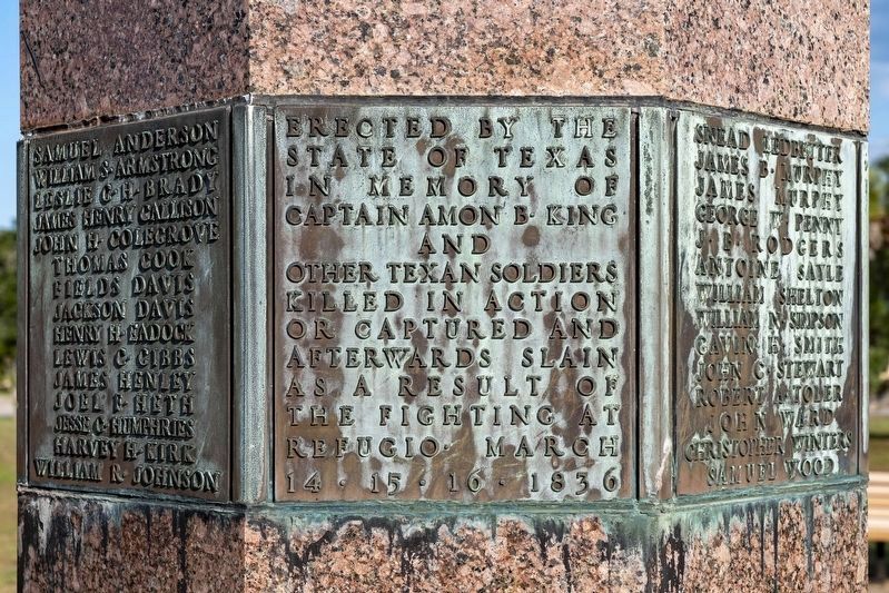
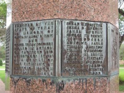
Erected by the State of Texas in memory of Captain Amon B. King and Texan soldiers killed in action or captured and afterwards slain as a result of the fighting at Refugio March 14, 15, 16, 1836.
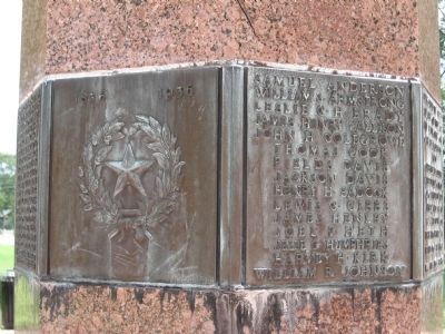
Samuel Anderson, William Armstrong, Leslie G.H. Brady, James Henry Callison, John H. Colegrave, Thomas Cook, Fields Davis, Henry H. Eadock, Lewis C. Gibbs, James Henley, Joel F. Heth, Jesse C. Humphries, Harvey H. Kirk, William R. Johnson, Snead Ledbetter, James B. Murphy, George W. Penny, J.B. Rodgers, Antoine Sayle, William
this page online
Erected 1936 by State of Texas. (Marker Number 152.)
Topics and series. This historical marker is listed in this topic list: War, Texas Independence. In addition, it is included in the Texas 1936 Centennial Markers and Monuments series list. A significant historical date for this entry is March 14, 1836.
Location. 28° 17.788′ N, 97° 16.491′ W. Marker is in Refugio, Texas, in Refugio County. It is on Osage Street near Purisma Street. In King's Park. Touch for map. Marker is in this post office area: Refugio TX 78377, United States of America. Touch for directions.

Regionally, this marker is in the American South and on the Gulf Coast. Globally, it is in North America, a Gulf of Mexico state, the Western Hemisphere, the Western World, and the Anglosphere. Historically, it finds itself in what was once New Spain, the Republic of Texas, and one of the Confederate States of America.
Other nearby markers. At least 8 other markers are within walking distance of this marker: Irish Immigrants in Refugio (within shouting distance of
Photographed by Mansfieldphoto.com, September 26, 2025
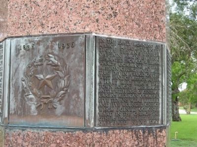
2. Amon B. King Marker
Photographed by Steve Gustafson, June 11, 2010
3. Amon B. King Marker
Photographed by Steve Gustafson, June 11, 2010
4. Amon B. King Marker
Photographed by Steve Gustafson, June 11, 2010
5. Amon B. King Marker
Photographed by Steve Gustafson, June 11, 2010
6. Amon B. King Marker
Photographed by Steve Gustafson, June 11, 2010
7. Amon B. King Marker
Credits. This page was last revised on October 13, 2025. It was originally submitted on August 5, 2010, by Steve Gustafson of Lufkin, Texas. This page has been viewed 2,508 times since then and 108 times this year. Photos: 1, 2. submitted on October 13, 2025, by James Hulse of Medina, Texas. 3, 4, 5, 6, 7. submitted on August 5, 2010, by Steve Gustafson of Lufkin, Texas. • Bill Pfingsten was the editor who published this page.
