West Liberty in Logan County, Ohio — The American Midwest (Great Lakes)
Shawnee Nation in Logan County / Shawnee Villages in Logan County
Inscription.
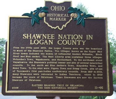
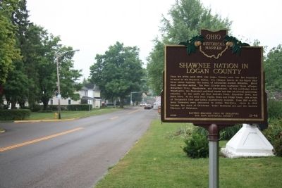
"Shawnee Nation in Logan County"
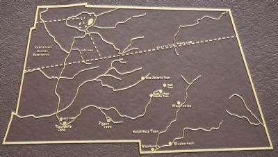
From the 1770s until 1832, the Logan County area was the homeland to much of the Shawnee Nation. Ten villages known as the Upper Mad River towns included the homes of influential leaders Moluntha, Black Hoof, and Blue Jacket. The West Liberty area contained three villages: Moluntha's Town, Wapakoneta, and Mackachack. To the northeast stood Wapatomica, the Shawnee's political center and site of several intertribal councils. To the north sat Blue Jacket's Town, Kispoktha Town, and Reed Town. To the west were Pigeon Town and Stony Creek, site of one of Tecumseh's first pan-Indian confederacy councils. From 1817 to 1832, many Shawnees were relocated to Indian Territory, which in 1907 became the state of Oklahoma. These Shawnees are now the Eastern Shawnee of Oklahoma.
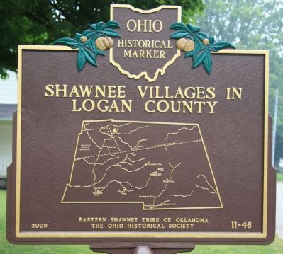
"Shawnee Villages in Logan County"
[Map of Shawnee Villages in Logan County]
Erected 2009 by Eastern Shawnee Tribe of Oklahoma and The Ohio Historical Society. (Marker Number 11-46.)
Topics and series. This historical marker is listed in this topic list: Native Americans. In addition, it is included in the Ohio Historical Society / The Ohio History Connection series list. A significant historical year for this entry is 1832.
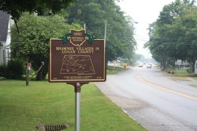
Location. 40° 15.348′ N, 83° 45.357′ W. Marker is in West Liberty, Ohio, in Logan County. Marker is at the intersection of U.S. 68 and North Detroit Street (County Route 189), on the right when traveling south on U.S. 68. This historical marker is on the west side of the road, situated in Memorial Park. Touch for map. Marker is in this post office area: West Liberty OH 43357, United States of America. Touch for directions.
Other nearby markers. At least 8 other markers are within walking distance of this marker. West Liberty World War I Memorial (a few steps from this marker); West Liberty / Glover Hall (about 700 feet away, measured in a direct line); Hull's Trace / Moluntha (about 800 feet away); Sherman M. Ricketts (approx. 0.2 miles away); Michael Lane Partin (approx. 0.2 miles away); West Liberty Veterans Memorial (approx. ¼ mile away); Foust Addition (approx. 0.4 miles away); West Liberty Lion's Club Park (approx. half a mile away). Touch for a list and map of all markers in West Liberty.
Also see . . .
1. Shawnee. Wikipedia website entry (Submitted on August 6, 2010, by Dale K. Benington of Toledo, Ohio.)
2. Shawnee Tribe. Tribe website homepage (Submitted on February 1, 2023, by Larry Gertner of New York, New York.)
Credits. This page was last revised on November 27, 2023. It was originally submitted on August 6, 2010, by Dale K. Benington of Toledo, Ohio. This page has been viewed 2,439 times since then and 119 times this year. Photos: 1, 2, 3, 4, 5, 6, 7. submitted on August 6, 2010, by Dale K. Benington of Toledo, Ohio.
