Goliad in Goliad County, Texas — The American South (West South Central)
Goliad Tornado of 1902
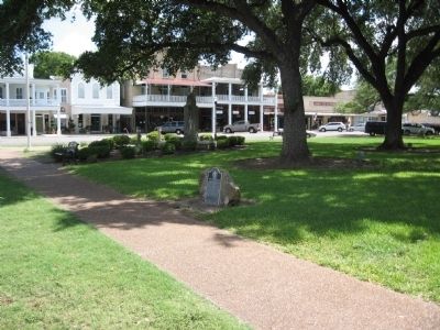
Erected 1978 by Texas Historical Commission. (Marker Number 2207.)
Topics. This historical marker is listed in this topic list: Disasters. A significant historical date for this entry is May 18, 1846.
Location. 28° 39.96′ N, 97° 23.545′ W. Marker is in Goliad, Texas, in Goliad County. Marker is on South Commercial Street, on the right when traveling north. Marker is located on the Courthouse Square. Touch for map. Marker is at or near this postal address: 127 North Courthouse Square, Goliad TX 77963, United States of America. Touch for directions.
Other nearby markers. At least 8 other markers are within walking distance of this marker. Goliad Global War Memorial (a few steps from this marker); Goliad County Courthouse (within shouting distance of this marker); The Hanging Tree (within shouting distance of this marker); Bull Durham Tobacco Wall Advertisement (within shouting distance of this marker); Santa Anna's Surrender Ratified (within shouting distance of this marker); John Mason Brewer (within shouting distance of this marker); Goliad County World War I Memorial (about 300 feet away, measured in a direct line); First Lieut. James H. Ewell Jr. Memorial (about 300 feet away). Touch for a list and map of all markers in Goliad.
Credits. This page was last revised on August 27, 2020. It was originally submitted on August 6, 2010, by Steve Gustafson of Lufkin, Texas. This page has been viewed 2,921 times since then and 117 times this year. Photos: 1, 2. submitted on August 6, 2010, by Steve Gustafson of Lufkin, Texas. 3. submitted on August 9, 2010, by Steve Gustafson of Lufkin, Texas. • Syd Whittle was the editor who published this page.


