Danbury in Stokes County, North Carolina — The American South (South Atlantic)
Moratock Iron Furnace
Rural Ironworks
| — | Confederate Lifeline | — |
Photographed by Bill Coughlin, August 6, 2010
1. Moratock Iron Furnace Marker
(Sidebar):
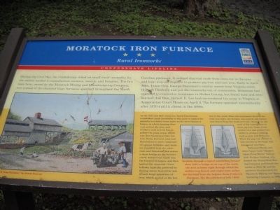
In the 18th and 19th centuries, North Carolinians established small ironworks in this area to exploit the plentiful ore belts. Some early works were bloomery forges, in which burning charcoal melted the iron, and workers used an iron bar to gather the pasty mess, which was then hammered into bar
this page online
Nathaniel Moody and John Pepper built “Moody’s Tunnel Iron Works” here in 1843. Reuben Golding, who formed the Stokes Iron Mining Company, purchased the works in 1854. He and his partners incorporated the Moratock Mining and Manufacturing Company in 1862.
Erected by Civil War Trails.
Topics and series. This historical marker is listed in this topic list: War, US Civil. In
Photographed by Bill Coughlin, August 6, 2010
2. Marker in Danbury
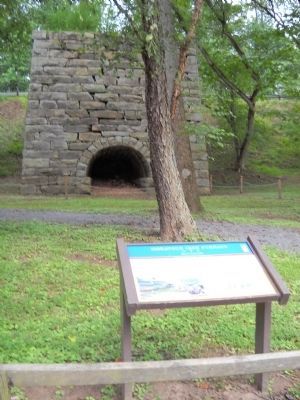
The remains of the Moratock Iron Furnace can be seen here behind the marker.
Location. 36° 24.489′ N, 80° 11.868′ W. Marker is in Danbury, North Carolina, in Stokes County. It can be reached from Shepherd Mill Road, on the right when traveling east. Marker is located in Moratock Park, near the Dan River. Touch for map. Marker is in this post office area: Danbury NC 27016, United States of America. Touch for directions.

Regionally, this marker is in the Piedmont. It is also in the American South and specifically in the Upper South. Globally, it is in North America, the Western Hemisphere, the Western World, and the Anglosphere. Historically, it finds itself in what was once the territory of the Mississippian Culture, one of the original Thirteen Colonies, one of the Confederate States of America, and the Antebellum South.
Other nearby markers. At least 8 other markers are within walking distance of this marker: Moratock Furnace (approx. 0.2 miles away); Danbury Presbyterian Church (approx. 0.3 miles away); Stokes County Historical Society Flagpoles
Photographed by Bill Coughlin, August 6, 2010
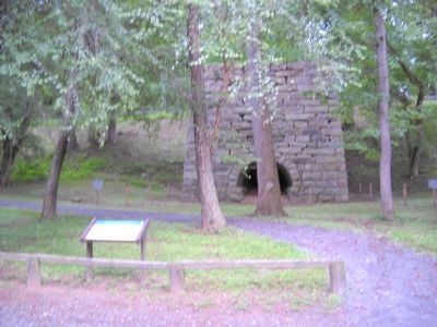
3. Marker in Moratock Park
More about this marker. The left side of the marker features a picture of the Moratock Iron Furnace, by Frank Duncan. The sidebar contains a cross section of a furnace with the caption “Sections through a typical antebellum furnace show (left) a bridge at the top of the stack, the arch at lower right through which the molten iron flowed, and (right) twin arches for the blast from the bellows. From Frederick Overman, The Manufacture of Iron (1850).”
Photographed by Bill Coughlin, August 6, 2010
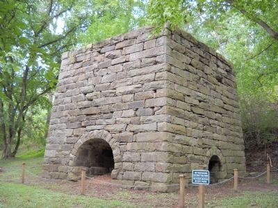
4. Moratock Iron Furnace
Union Gen. George Stoneman disabled this charcoal furnace during his April 1865 Raid of North Carolina.
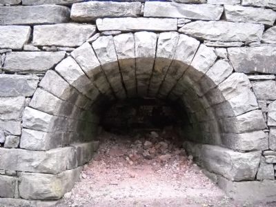
Photographed by Bill Coughlin, August 6, 2010
5. Moratock Iron Furnace
Credits. This page was last revised on March 9, 2021. It was originally submitted on August 7, 2010, by Bill Coughlin of Woodland Park, New Jersey. This page has been viewed 2,624 times since then and 124 times this year. Photos: 1, 2, 3, 4, 5. submitted on August 7, 2010, by Bill Coughlin of Woodland Park, New Jersey.
