Tampa in Hillsborough County, Florida — The American South (South Atlantic)
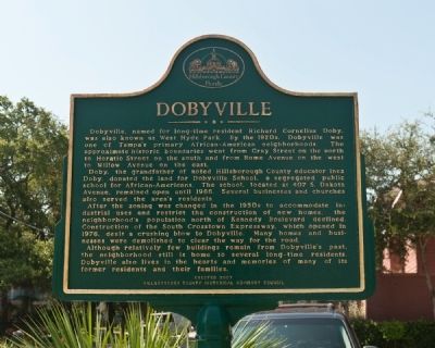
Dobyville
Doby, the grandfather of noted Hillsborough County educator Inez Doby, donated the land for Dobyville School, a segregated public school for African-Americans. The school, located at 407 S. Dakota Avenue, remained open until 1966. Several businesses and churches also served the area's residents.
After the zoning was changed in the 1950's to accommodate industrial uses and restrict the construction of new homes, the neighborhood's population north of Kennedy Boulevard declined. Construction of the South Crosstown Expressway, which opened in 1976, dealt a crushing blow to Dobyville. Many homes and businesses were demolished to clear the way for the road.
Although relatively few buildings remain from Dobyville's past, the neighborhood still is home to several long-time residents. Dobyville also lives in the hearts and memories of many of its former residents and their families.
Erected 2007 by Hillsborough County Historical Advisory Council.
Topics. This historical marker is listed in these topic lists: African Americans • Education • Settlements & Settlers. A significant historical year for this entry is 1966.
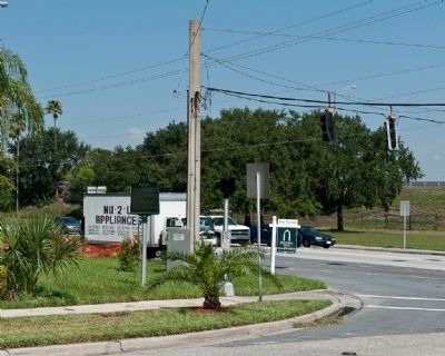
Location. 27° 56.492′ N, 82° 28.367′ W. Marker is in Tampa, Florida, in Hillsborough County. Marker is at the intersection of W. Platt and S. Willow Ave on W. Platt. Touch for map. Marker is in this post office area: Tampa FL 33606, United States of America. Touch for directions.
Other nearby markers. At least 8 other markers are within walking distance of this marker. The Rough Riders Procure a Coal Train (approx. 0.2 miles away); Alfred Reuben Swann (approx. 0.3 miles away); Woodrow Wilson Junior High School (approx. 0.3 miles away); William Gordon Burnett (approx. 0.3 miles away); Old Hyde Park (approx. 0.4 miles away); Jessamine Flowers Link (approx. 0.4 miles away); Hyde Park's Bungalow Terrace (approx. half a mile away); Plant Field (approx. half a mile away). Touch for a list and map of all markers in Tampa.
Credits. This page was last revised on June 16, 2016. It was originally submitted on August 10, 2010, by Ronald Claiborne of College Station, Texas. This page has been viewed 1,706 times since then and 70 times this year. Photos: 1, 2. submitted on August 10, 2010, by Ronald Claiborne of College Station, Texas. • Bill Pfingsten was the editor who published this page.

