Near Millboro Springs in Bath County, Virginia — The American South (Mid-Atlantic)
Bath County / Rockbridge County
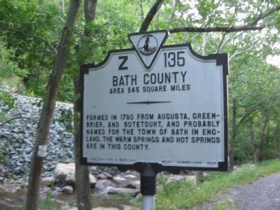
Bath County. Area 545 Square Miles. Formed in 1790 from Augusta, Greenbrier, and Botetourt, and probably named for the town of Bath in England. The warm springs and hot springs are in this county.
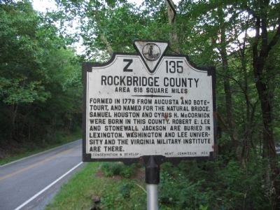
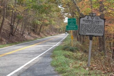
Rockbridge County. Area 616 Square Miles. Formed in 1778 from Augusta and Botetourt, and named for the natural bridge. Samuel Houston and Cyrus H. McCormick were born in this county. Robert E. Lee and Stonewall Jackson are buried in Lexington. Washington and Lee University and the Virginia Military Institute are there.
Erected 1934 by Conservation & Development Commission. (Marker Number Z-135.)
Topics and series. This historical marker is listed in this topic list: Political Subdivisions. In addition, it is included in the Virginia Department of Historic Resources (DHR) series list. A significant historical year for this entry is 1790.
Location. 38° 0.182′ N, 79° 32.079′ W. Marker is near Millboro Springs, Virginia, in Bath County. Marker is on Maury River Road (State Highway 39), on the right when traveling east. Located in Panther Gap along Mill Creek. Touch for map. Marker is in this post office area: Millboro VA 24460, United States of America. Touch for directions.
Other nearby markers. At least 8 other markers are within 8 miles of this marker, measured as the crow flies. Goshen First Aid Crew Inc. (approx. 2˝ miles away); T. C. Walker School (approx. 3.3 miles away); Millboro (approx. 4.2 miles away); Youel-Condon House (approx. 4˝ miles away); Windy Cove Presbyterian Church (approx. 5.4 miles away); Camp Mont Shenandoah (approx. 5.9 miles away); Rockbridge County / Augusta County (approx. 6.9 miles away); Fort Dickinson (approx. 7.2 miles away). Touch for a list and map of all markers in Millboro Springs.
Credits. This page was last revised on July 3, 2021. It was originally submitted on August 11, 2010, by Craig Swain of Leesburg, Virginia. This page has been viewed 671 times since then and 21 times this year. Photos: 1, 2. submitted on August 11, 2010, by Craig Swain of Leesburg, Virginia. 3. submitted on October 16, 2013, by J. J. Prats of Powell, Ohio.


