Marlinton in Pocahontas County, West Virginia — The American South (Appalachia)
Marlinton
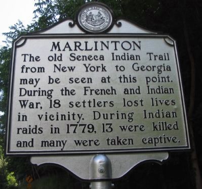
The old Seneca Indian Trail from New York to Georgia may be seen at this point. During the French and Indian War, 18 settlers lost lives in vicinity. During Indian raids in 1779, 13 were killed and many were taken captive.
(back)
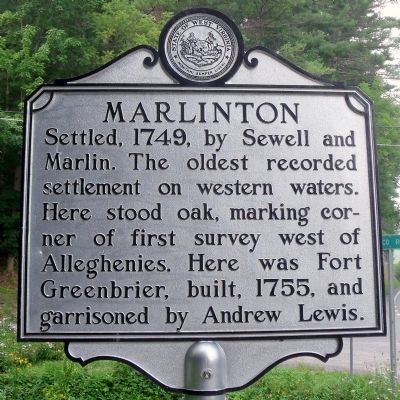
Settled, 1749, by Sewell and Marlin. The oldest recorded settlement on western waters. Here stood oak, marking corner of first survey west of Alleghenies. Here was Fort Greenbrier, built, 1755, and garrisoned by Andrew Lewis.
Topics and series. This historical marker is listed in these topic lists: Exploration • Forts and Castles • Settlements & Settlers. In addition, it is included in the West Virginia Archives and History series list. A significant historical year for this entry is 1779.
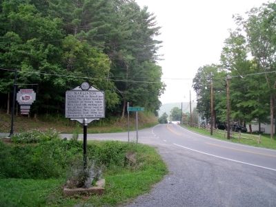
Location. 38° 13.391′ N, 80° 6.015′ W. Marker is in Marlinton, West Virginia, in Pocahontas County. Marker is at the intersection of Seneca Trail (U.S. 219) and Jerico Road (County Route 19), on the left when traveling north on Seneca Trail. Touch for map. Marker is in this post office area: Marlinton WV 24954, United States of America. Touch for directions.
Other nearby markers. At least 8 other markers are within 5 miles of this marker, measured as the crow flies. Welcome to Pocahontas County (about 700 feet away, measured in a direct line); Frank and Anna Hunter House (about 700 feet away); Greenbrier Covered Bridge (approx. ¼ mile away); Marlinton: Heritage (approx. 0.4 miles away); Natural History and Heritage (approx. 2.9 miles away); Edray (approx. 3.3 miles away); Big Lime (approx. 3.6 miles away); Huntersville Jail / Presbyterian Church (approx. 5 miles away). Touch for a list and map of all markers in Marlinton.
Credits. This page was last revised on November 14, 2021. It was originally submitted on August 14, 2010, by Bernard Fisher of Richmond, Virginia. This page has been viewed 689 times since then and 27 times this year. Photos: 1. submitted on August 15, 2010, by Craig Swain of Leesburg, Virginia. 2, 3. submitted on August 14, 2010, by Bernard Fisher of Richmond, Virginia.


