Paola in Miami County, Kansas — The American Midwest (Upper Plains)
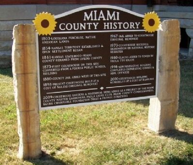
Miami County History
1803 - Louisiana Purchase, Native American Lands
1854 - Kansas Territory established & open settlement began
1861 - Kansas Statehood - Miami County renamed from Lykins County
1873 - First courthouse on this site converted from a former public school building
1880 - County jail added west of this site
1898 - Present courthouse built at a cost of $6,152 (original removed)
1967 - Jail added to courthouse (original removed)
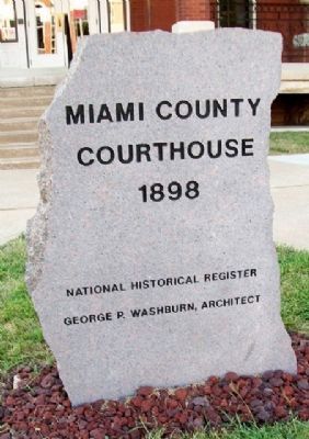
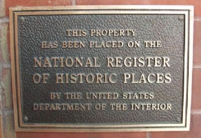
1973 - Courthouse receives designation on National Historic Register
1980 - Clocks added to tower by Paola 7th Grade
1998 - Administrative building completed (separating courts & adm. offices)
2000 - Courthouse building remodeled at a cost of $1,600,000
2009 - Courthouse gardens & historical signs added...
Erected 2009 by Miami County Master Gardeners, Paola Lions Club, Miami County Commissioners, Baehr Charitable Foundation Trust & Private Donations.
Topics. This historical marker is listed in this topic list: Political Subdivisions. A significant historical year for this entry is 1803.
Location. 38° 34.248′ N, 94° 52.712′ W. Marker is in Paola, Kansas, in Miami County. Marker is on Pearl Street near Miami Street, on the right when traveling south. Marker is near the east entrance to the Miami County Courthouse. Touch for map. Marker is in this post office area: Paola KS 66071, United States of America. Touch for directions.
Other nearby markers. At least 8 other markers are within 7 miles of this marker, measured as the crow flies. Paola Veterans' Memorial (about 500 feet away, measured in a direct line); Baptiste & Mary Ann Peoria (about 700 feet away); City Hall Fire Bell (approx. 0.2 miles away); Miami County Veterans Memorial (approx. 0.8 miles away); Original Land Office (approx. 6.2 miles away); The Potawatomi Trail of Death (approx. 6.2 miles away); John Brown Country (approx. 6.2 miles away); Land Office (approx. 6.2 miles away). Touch for a list and map of all markers in Paola.
Also see . . .
1. Miami County, Kansas Official Site. (Submitted on August 14, 2010, by William Fischer, Jr. of Scranton, Pennsylvania.)
2. Miami County History. (Submitted on August 14, 2010, by William Fischer, Jr. of Scranton, Pennsylvania.)
Credits. This page was last revised on June 16, 2016. It was originally submitted on August 14, 2010, by William Fischer, Jr. of Scranton, Pennsylvania. This page has been viewed 707 times since then and 18 times this year. Photos: 1, 2, 3, 4, 5. submitted on August 14, 2010, by William Fischer, Jr. of Scranton, Pennsylvania.


