Near Belington in Barbour County, West Virginia — The American South (Appalachia)
Welcome to Camp Laurel Hill
Gateway to the Northwest
Inscription.
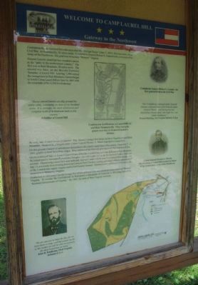
Confederate forces retreated from this area after the "Philippi Races" (June 3, 1861), first land battle of the Civil War. At Huttonsville, 26 miles south, Confederate General Robert S. Garnett took command of the Army of the Northwest. His goal was to reclaim "Western" Virginia.
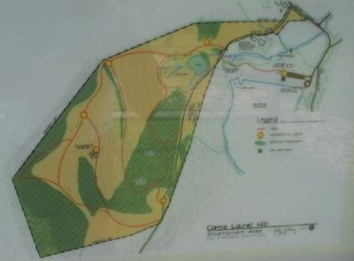
General Garnett identified two mountain passes as the "gates to the northwestern country." The first was at Rich Mountain, 20 miles south. The second was here, on the Beverly-Fairmont Turnpike, at Laurel Hill. Leaving 1,300 men at the stronger post at Rich Mountain, Garnett began to fortify Camp Laurel Hill on June 16, 1861 with the remainder of his 5,300 Confederates.
"Heavy entrenchments are dug around the entire camp, containing an area of one hundred acres. It is, perhaps, the most substantial and complete work of its kind ever built in this country."
A Soldier at Laurel Hill
By early July, Federal troops threatened. Maj. General George McClellan led three brigades toward Rich Mountain. Meanwhile, a brigade under Union General Thomas A. Morris marched to Laurel Hill.
On this ground, Garnett's Confederates skirmished with a nearly equal force of the enemy. From July 7-11, 1861, gunfire echoed from these ridges. Here soldiers of the blue and gray received their baptism of fire.
On the evening of July 11, General Garnett learned that the Confederates had been defeated at Rich Mountain. He feared that the Staunton-Parkersburg Turnpike - his vital supply line to the Shenandoah Valley - had been severed. Abandoning Laurel Hill near midnight, Garnett's army struck east, in a daring bid to escape. On July 13, at a lonely river crossing known as Corricks Ford (Tucker County), pursuing Federals captured most of the Confederate supply wagons and killed General Garnett. Demoralized Confederates fled across the mountains to Monterey, Virginia.
Events here in 1861 made General George McClellan a national hero, and solidified Union control of "Western" Virginia. To counter the Confederates in Richmond, a delegation of Unionists in Wheeling formed the "Restored Government of Virginia." By 1863, the state of West Virginia was born.
"Our Confederate command under General Garnett confronted that of the Federals under General Morris ... and during that time skirmishing between them, with slight loss, was almost continuous."
French Harding, 31st Virginia Infantry C.S.A.
"We are anxious to meet the foe, for we have them to whip, and the sooner we do it, the sooner we will be able to return to the dear loved ones at home."
John B. Pendleton, 23rd Virginia Infantry C.S.A.
Topics. This historical marker is listed in this topic list: War, US Civil. A significant historical month for this entry is June 1953.
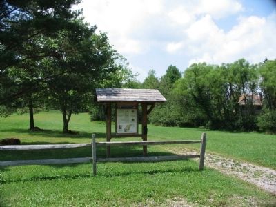
Location. 39° 0.513′ N, 79° 54.533′ W. Marker is near Belington, West Virginia, in Barbour County. Marker can be reached from Laurel Mountain Road (County Route 15), on the right when traveling east. Located in Laurel Hill Camp beside the Mill Creek Reservoir. Touch for map. Marker is in this post office area: Belington WV 26250, United States of America. Touch for directions.
Other nearby markers. At least 8 other markers are within walking distance of this marker. Laurel Hill Battlefield Veterans Memorial (within shouting distance of this marker); In Honor of these whose Sacrifices Created this Hallowed Ground (within shouting distance of this marker); Laurel Hill (about 300 feet away, measured in a direct line); Civil War (about 400 feet away); Camp Laurel Hill (about 800 feet away); a different marker also named Laurel Hill (approx. 0.2 miles away); Forced Flight (approx. ¼ mile away); Battle of Laurel Hill (approx. ¼ mile away). Touch for a list and map of all markers in Belington.
Also see . . . Battle of Laurel Hill. (Submitted on August 15, 2010, by Craig Swain of Leesburg, Virginia.)
Credits. This page was last revised on April 28, 2023. It was originally submitted on August 15, 2010, by Craig Swain of Leesburg, Virginia. This page has been viewed 1,150 times since then and 39 times this year. Photos: 1, 2, 3. submitted on August 15, 2010, by Craig Swain of Leesburg, Virginia.


