Olathe in Johnson County, Kansas — The American Midwest (Upper Plains)
Westward Ho!
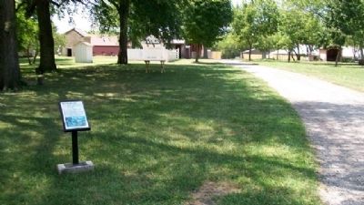
You are traveling in the path of countless men, women, and children who passed this very home in the 1860s! When you turned into the parking lot, you pulled off the Westport Route of the Santa Fe, Oregon, and California Trails. And now, you're approaching the only stagecoach stop open to the public on the Santa Fe Trail.
The Westport Route was one of several roads leading from Westport, Independence, and other Missouri towns; the famous "jumping off" points for the trip west. Travelers headed for Santa Fe, Oregon, and California used the Westport and other routes to cross what is today, the Kansas City metro area. Several miles south of here, at the Lone Elm campground (now a park which is also managed by the city of Olathe) these routes converged. For the next few miles, a single, main road carried all travelers heading west before splitting in two: with the Santa Fe Trail leading southwest, and the Oregon/California Trail, heading northwest.
Erected by City of Olathe.
Topics and series. This historical marker is listed in these topic lists: Exploration • Industry & Commerce • Roads & Vehicles • Settlements & Settlers. In addition, it is included in the California Trail series list.
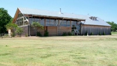
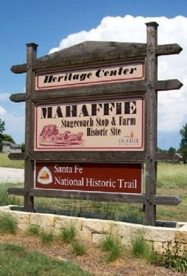
Location. 38° 53.541′ N, 94° 48.032′ W. Marker is in Olathe, Kansas, in Johnson County. Marker is about 200 feet west of the Heritage Center at Mahaffie Stagecoach Stop and Farm. Touch for map. Marker is at or near this postal address: 1200 Kansas City Road, Olathe KS 66061, United States of America. Touch for directions.
Other nearby markers. At least 8 other markers are within walking distance of this marker. Check that Cornfield (a few steps from this marker); There's No Roost Like Home (within shouting distance of this marker); Up In Smoke (within shouting distance of this marker); Home Sweet Home (within shouting distance of this marker); Fast Food (within shouting distance of this marker); Pit Stop (about 300 feet away, measured in a direct line); Stagecoach Drivers (about 300 feet away); State Your Business... (about 300 feet away). Touch for a list and map of all markers in Olathe.
Also see . . .
1. Mahaffie Stagecoach Stop and Farm. Olathe webpage. (Submitted on August 15, 2010, by William Fischer, Jr. of Scranton, Pennsylvania.)
2. Santa Fe National Historic Trail. (Submitted on August 15, 2010, by William Fischer, Jr. of Scranton, Pennsylvania.)
3. Oregon-Calfornia Trails Association. (Submitted on August 15, 2010, by William Fischer, Jr. of Scranton, Pennsylvania.)
4. Santa Fe Trail Association. Association website (Submitted on August 15, 2010, by William Fischer, Jr. of Scranton, Pennsylvania.)
5. The Interactive Santa Fe Trail. (Submitted on August 15, 2010, by William Fischer, Jr. of Scranton, Pennsylvania.)
Credits. This page was last revised on December 30, 2020. It was originally submitted on August 15, 2010, by William Fischer, Jr. of Scranton, Pennsylvania. This page has been viewed 1,138 times since then and 20 times this year. Photos: 1, 2, 3, 4. submitted on August 15, 2010, by William Fischer, Jr. of Scranton, Pennsylvania.


