Holly in Oakland County, Michigan — The American Midwest (Great Lakes)
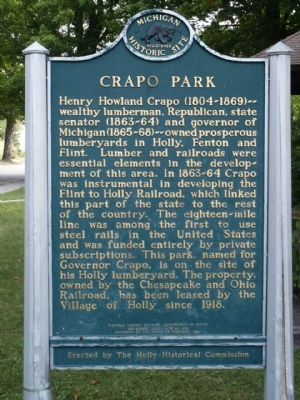
Crapo Park
Erected 1980 by Michigan History Division, Department of State/The Holly Historical Commission. (Marker Number L0832.)
Topics and series. This historical marker is listed in these topic lists: Government & Politics • Industry & Commerce • Railroads & Streetcars. In addition, it is included in the Michigan Historical Commission series list. A significant historical year for this entry is 1918.
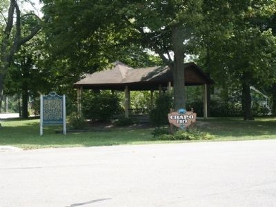
Location. 42° 47.452′ N, 83° 37.498′ W. Marker is in Holly, Michigan, in Oakland County. Marker is at the intersection of Martha Street and John Street, on the right when traveling east on Martha Street. Touch for map. Marker is in this post office area: Holly MI 48442, United States of America. Touch for directions.
Other nearby markers. At least 8 other markers are within 4 miles of this marker, measured as the crow flies. Battle Alley (about 500 feet away, measured in a direct line); Holly's Town Hall (about 800 feet away); This is the Site of the Holly Milling Co. (approx. 0.3 miles away); 1834 Clark Dibble Settlement (approx. 4 miles away); 1840 Grindstone from Fenton Mills (approx. 4 miles away); Fenton United Methodist Church (approx. 4.1 miles away); Saint Jude's Episcopal Church (approx. 4.1 miles away); Dibbleville Business District I (approx. 4.1 miles away). Touch for a list and map of all markers in Holly.
Also see . . . Henry H. Crapo - Wikipedia. Govenor of Michigan (Submitted on August 19, 2010, by Bill Pfingsten of Bel Air, Maryland.)
Credits. This page was last revised on June 16, 2016. It was originally submitted on August 16, 2010, by Joel Seewald of Madison Heights, Michigan. This page has been viewed 1,589 times since then and 70 times this year. Photos: 1, 2, 3. submitted on August 16, 2010, by Joel Seewald of Madison Heights, Michigan. • Bill Pfingsten was the editor who published this page.


