Near The Dalles in Wasco County, Oregon — The American West (Northwest)
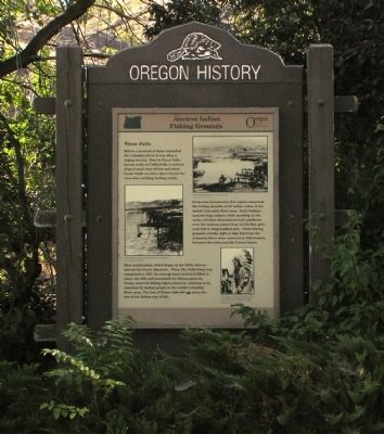
Ancient Indian Fishing Grounds
Wyam Falls

Photographed By Paul Crumlish, August 1, 2010
1. Ancient Indian Fishing Grounds Marker
Captions: (center left) Long-handled nest caught Chinook, Sockeye, and Coho Salmon.; (upper right) Natives (Indians) fishing the Falls prior to dam construction.; (bottom right) Chief Tommy Thompson 1853-1959 (?) For many years Thompson headed the group of tribal leaders who supervised fishing at the Falls.
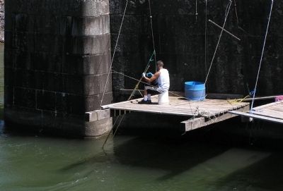
From time immemorial this region comprised the fishing grounds of all Indian tribes of the middle Columbia River area. Early Indians speared huge salmon while on the rocks and their descendants built platforms over the rushing waters from which they gathered fish in long-handled nets. These fishing grounds and the right to take fish from the Columbia River were reserved in 1855 treaties between the tribes and the United States.
Dam construction, which began in the 1930s, forever altered the river’s character. When The Dalles Dam was completed in 1957, the storage basin behind it filled in above the falls and inundated the fishing grounds. Treaty reserved fishing rights, however, continue to be exercised by Indian people of the middle Columbia River area. The loss of Wyam Falls did not mean the loss of the Indian way of life.
Erected by Oregon Department of Transportation and Oregon Travel Information Council.
Topics and series. This historical marker is listed in this topic list: Native Americans . In addition, it is included in the Oregon Beaver Boards series list. A significant historical year for this entry is 1855.
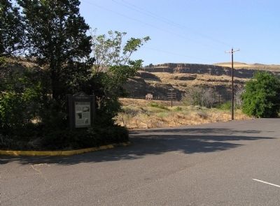
Location. 45° 39.003′ N, 120° 57.632′ W. Marker is near The Dalles, Oregon, in Wasco County. Marker can be reached from Celilo Park Road, 0.1 miles south of Celilo-Wasco Highway (Oregon Road 206), on the right when traveling west. Celilo Park Road becomes the parking lot for Celilo Park. The marker is on eastern side of the parking lot. Touch for map. Marker is in this post office area: The Dalles OR 97058, United States of America. Touch for directions.
Other nearby markers. At least 8 other markers are within walking distance of this marker. Greatest Indian Fishery of the Northwest (within shouting distance of this marker); The Lewis and Clark Expedition (within shouting distance of this marker); Celilo Falls Fishing Grounds (about 400 feet away, measured in a direct line); Class P-2 Engine No. 2507 (approx. 0.6 miles away in Washington); Great Falls of the Columbia (approx. 0.9 miles away in Washington); Wyam (approx. 0.9 miles away in Washington); Celilo Falls (approx. 0.9 miles away in Washington); View of Mount Jefferson (approx. 0.9 miles away in Washington). Touch for a list and map of all markers in The Dalles.
Credits. This page was last revised on October 20, 2020. It was originally submitted on August 19, 2010, by PaulwC3 of Northern, Virginia. This page has been viewed 1,631 times since then and 42 times this year. Photos: 1, 2, 3. submitted on August 19, 2010, by PaulwC3 of Northern, Virginia. 4. submitted on August 20, 2010, by PaulwC3 of Northern, Virginia.


