Solomons in Calvert County, Maryland — The American Northeast (Mid-Atlantic)
J. C. Lore & Sons Oyster House
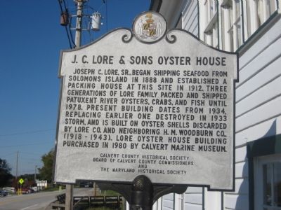
Photographed by F. Robby, November 7, 2007
1. J. C. Lore & Sons Oyster House Marker
Erected 1987 by Calvert County Historical Society, Board of Calvert County Commissioners, Maryland Historical Society.
Topics and series. This historical marker is listed in these topic lists: Animals • Industry & Commerce. In addition, it is included in the Maryland Historical Trust, and the National Historic Landmarks series lists. A significant historical year for this entry is 1888.
Location. 38° 19.45′ N, 76° 27.651′ W. Marker is in Solomons, Maryland, in Calvert County. It is on Solomons Island Road (Maryland Route 2) 0.6 miles south of Lore Road, on the left when traveling south. Touch for map. Marker is in this post office area: Solomons
this page online

Regionally, this marker is in Southern Maryland. It is also in the American South, specifically in the Upper South, in the Mid-Atlantic, in the Tidewater, in the Chesapeake Bay Region, and on the Eastern Seaboard. Globally, it is in the North Atlantic Region, North America, the Western Hemisphere, the Western World, and the Anglosphere. Historically, it finds itself in what was once one of the original Thirteen Colonies and also the Antebellum South.
Other nearby markers. At least 8 other markers are within walking distance of this marker: The Chesapeake Bay Bugeye (a few steps from this marker); Tide Box (within shouting distance of this marker); Patuxent Ghost Fleet (1927-1941) (within shouting distance of this marker); War of 1812 (about 600 feet away, measured in a direct line); M. M. Davis Shipyard (about 700 feet away); Watery Grave (about 700 feet away); Governor Thomas Johnson Bridge (approx. 0.2 miles away); Point Patience (approx. ¼ mile away). Touch for a list and map of all markers in Solomons.
Additional commentary.
1. Landmark status
The J. C.
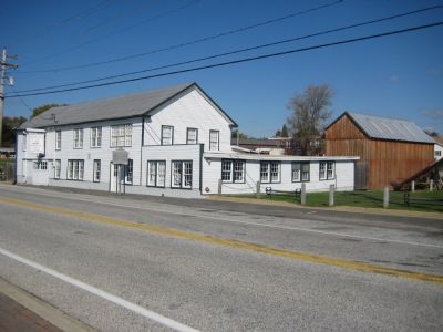
Photographed by F. Robby, November 7, 2007
2. Oyster House
— Submitted March 3, 2008, by Christopher Busta-Peck of Shaker Heights, Ohio.
Credits. This page was last revised on December 21, 2024. It was originally submitted on November 11, 2007, by F. Robby of Baltimore, Maryland. This page has been viewed 1,889 times since then and 35 times this year. Photos: 1, 2. submitted on November 11, 2007, by F. Robby of Baltimore, Maryland.
