Riverton in Salt Lake County, Utah — The American Mountains (Southwest)
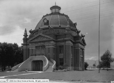
Early Riverton and the Magnificent Dome Church
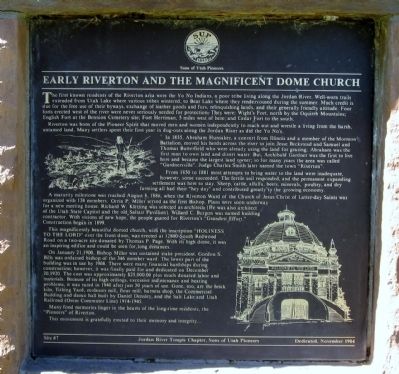
Inscription.
The first known residents of the Riverton area were the Yo No Indians, a poor tribe living along the Jordan River. Well-worn trails extended from Utah Lake where various tribes wintered, to Bear Lake where they rendezvoused during the summer. Much credit is due for the free use of their byways, exchange of leather goods and furs. relinquishing lands, and their generally friendly attitude. Four forts erected west of the river were never seriously needed for protection. They were: Wight's Fort, north by the Oquirrh Mountains; English Fort at the Bennion Cemetery site; Fort Herriman, 5 miles west of here; and Cedar Fort to the south.
Riverton was born of the Pioneer Spirit that moved men and women independently to reach out and wrestle a living from the harsh untamed land. Many settlers spent their first year in the dug-outs along the Jordan River as did the Yo No's.
In 1855, Abraham Hunsaker, a convert from Illinois and a member of the Mormon Battalion, moved his herds across the river to join Jesse Beckstead and Samuel and Thomas Butterfield who were already using the land for grazing. Abraham was the first man to own land and divert water. But, Archibald Gardner was the first to live here and became the largest land owner; so for many years the area was called "Gardnersville". Judge Charles Smith later named the town "Riverton".
From 1850 to 1881, most attempts to bring water to the land were inadequate, however, some succeeded. The fertile soil responded, and the permanent expanding settlement was here to stay. Sheep, cattle, alfalfa, beets, minerals, poultry, and dry farming all had their "hey day" and contributed greatly to the growing economy.
A maturity milestone was reached August 8, 1886, when the Riverton Ward of the Church of Jesus Christ of Latter-day Saints was organized with 138 members. Orrin P. Miller served as the first Bishop. Plans were soon underway for a new meeting house. Richard W. Kletting was selected as architect (He was also architect of the Utah State Capitol and the old Saltair Pavilion). Willard C. Burgon was named building contractor. With visions of new hope, the people geared for Riverton's "Grandest Effort." Construction began in 1899.
This magnificently beautiful domed church, with the inscription "Holiness To The Lord" over the front door, was erected at 12800 South Redwood Road on a two-acre site donated by Thomas P. Page. With its high dome, it was an inspiring edifice and could be seen for long distances.
On January 21, 1900, Bishop Miller was sustained as stake president. Gordon S. Bills was ordained bishop of the 346 member ward. The lower part of the building was in use by 1908. There were many
financial hardships during construction; however, it was finally paid for and dedicated on December 20, 1920. The cost was approximately $25,000.00 plus much donated labor and materials. Because if its high ceilings, excessive maintenance and heating problems, it was razed in 1940 after just 30 years of use. Gone, too, are the brick kiln, Tithing Yard, molasses mill, flour, mill, harness shop, the Commercial Building, and dance hall built by Daniel Densley, and the Salt Lake and Utah Railroad (Orem Commuter Line) 1914-1945.
Many fond memories linger in the hearts of long-time residents, the "Pioneers" of Riverton,
This monument is gratefully erected to their memory and integrity...
Erected 1984 by Jordon River Temple Chapter, Sons of Utah Pioneers. (Marker Number 7.)
Topics and series. This historical marker is listed in these topic lists: Churches & Religion • Forts and Castles • Native Americans • Settlements & Settlers. In addition, it is included in the Sons of Utah Pioneers series list. A significant historical month for this entry is January 1795.
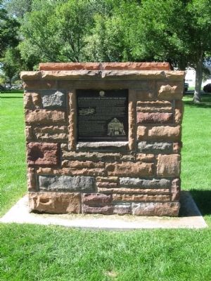
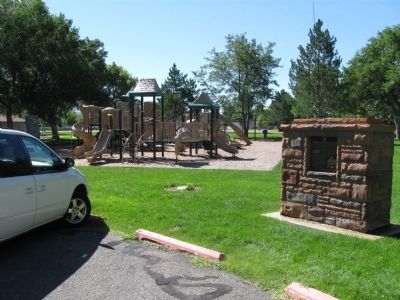
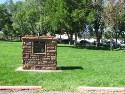
Location. 40° 31.179′ N, 111° 56.01′ W. Marker is in Riverton, Utah, in Salt Lake County. Marker is on 1500 West, on the right when traveling north. The marker is located within Riverton City Park.
Touch for map. Marker is at or near this postal address: 12641 South 1500 West, Riverton UT 84065, United States of America. Touch for directions.
Other nearby markers. At least 8 other markers are within 3 miles of this marker, measured as the crow flies. Riverton Tithing Yard Hill (within shouting distance of this marker); War Memorial (approx. 1.9 miles away); Wardle Fields Regional Park (approx. 2.1 miles away); Early Settlers of Bluffdale (approx. 2.3 miles away); Rockwell Station (approx. 2.7 miles away); South Jordan Cemetery (approx. 2.8 miles away); South Jordan Settlement (approx. 2.8 miles away); 1938 School Bus/Train Accident Memorial (approx. 2.8 miles away).
Also see . . . The History of Riverton. The structure was ready for use in the summer of 1908 and was dedicated on December 20, 1920. It was used by the Riverton Ward, which after Bishop Miller was presided over by Bishops Gordon S. Bills (1900-1921) and David Bills (1921-1927), until the ward's division in 1927. The old dome church, as it has come to known, continued to be used by the Riverton First Ward until it was torn down in 1940. (Submitted on August 26, 2010.)
Credits. This page was last revised on June 16, 2016. It was originally submitted on August 21, 2010, by Jack Duffy of West Jordan, Utah. This page has been viewed 2,794 times since then and 72 times this year. Photos: 1, 2, 3, 4. submitted on August 21, 2010, by Jack Duffy of West Jordan, Utah. 5. submitted on August 27, 2010, by Jack Duffy of West Jordan, Utah. • Syd Whittle was the editor who published this page.
