Wharton Township near Farmington in Fayette County, Pennsylvania — The American Northeast (Mid-Atlantic)
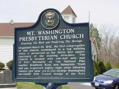
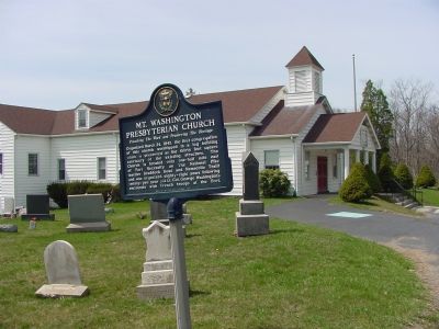
Mt. Washington Presbyterian Church
Preaching the Word and Preserving the Heritage.
Organized March 24, 1842, the first congregation of this church worshipped in a log building which is preserved as the thirty feet square sanctuary of the existing structure. The church is located only one-half mile east of Fort Necessity on the National Pike (earlier Braddock Road and Nemacolin Trail) and was organized eighty-eight years following twenty-two year old Lt. Col. George Washington's encounter with French troops at the Fort.
Erected 1974 by the congregation.
Topics. This historical marker is listed in this topic list: Churches & Religion. A significant historical date for this entry is March 24, 1830.
Location. 39° 48.771′ N, 79° 34.645′ W. Marker is near Farmington, Pennsylvania, in Fayette County. It is in Wharton Township. Marker is on National Pike (U.S. 40) west of Farmington-Ohiopyle Road (Pennsylvania Route 381), on the left when traveling west. Touch for map. Marker is in this post office area: Grindstone PA 15442, United States of America. Touch for directions.
Other nearby markers. At least 5 other markers are within walking distance of this marker. Fort Necessity National Battlefield (approx. half a mile away); The Great Meadows Campaign (approx. half a mile away); Do you measure up in Washington's Army? / Are you dressed for the campaign? (approx. half a mile away); Civilian Conservation Corps at Fort Necessity (approx. half a mile away); The Great Meadows (approx. half a mile away). Touch for a list and map of all markers in Farmington.
Credits. This page was last revised on February 7, 2023. It was originally submitted on May 12, 2006, by J. J. Prats of Powell, Ohio. This page has been viewed 1,858 times since then and 44 times this year. Photos: 1, 2. submitted on May 12, 2006, by J. J. Prats of Powell, Ohio.

