
Near Cordele in Crisp County, Georgia — The American South (South Atlantic)
Georgia Veterans Memorial State Park
Camp Safety Patrol
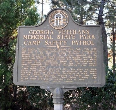
Photographed by David Seibert, January 15, 2012
1. Georgia Veterans Memorial State Park Marker
“Camp Safety Patrol,” established 1951, lies along the South border of the Memorial Park and was sponsored by the Safety Education Division of the Georgia Department of Public Safety and the Georgia Department Veterans of Foreign Wars, and proved to be the first School Patrol Safety Training Camp in the nation dedicated to teaching safety to youth.
Erected 1956 by Georgia Historical Commission. (Marker Number 040-5.)
Topics and series. This historical marker is listed in these topic lists: Education • Patriots & Patriotism
this page online
Location. 31° 57.233′ N, 83° 54.967′ W. Marker is near Cordele, Georgia, in Crisp County. It is on Clay Pit Road 0.1 miles south of Georgia Veterans Road, on the right when traveling south. The marker is located in Georgia Veterans Memorial State Park (fee required), at the entrance to the Lake Blackshear Golf Club and Resort, built on the site of Camp Safety Patrol. Touch for map. Marker is in this post office area: Cordele GA 31015, United States of America. Touch for directions.

Regionally, this marker is in Georgia’s Piedmont. It is also in the American South and specifically in the Deep South. Globally, it is in North America, the Western Hemisphere, the Western World, and the Anglosphere. Historically, it finds itself in what was once the territory of the Mississippian Culture, one of the original Thirteen Colonies, one of the Confederate States of America, and the Antebellum South.
Other nearby markers. At least 8 other markers are within walking distance of this marker:
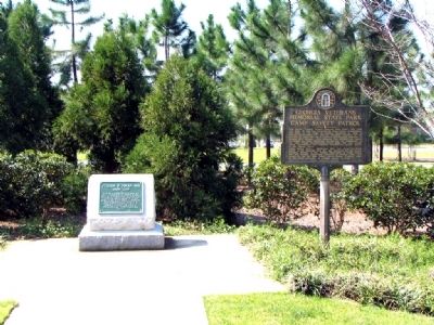
Photographed by David Seibert, March 13, 2007
2. Georgia Veterans Memorial State Park Marker
Related marker. Click here for another marker that is related to this marker. To better understand the relationship, study each marker in the order shown.
Additional keywords. Parks
Credits. This page was last revised on December 12, 2017. It was originally submitted on August 29, 2010, by David Seibert of Sandy Springs, Georgia. This page has been viewed 1,355 times since then and 19 times this year. Photos: 1. submitted on March 21, 2012, by David Seibert of Sandy Springs, Georgia. 2. submitted on August 29, 2010, by David Seibert of Sandy Springs, Georgia. • Craig Swain was the editor who published this page.
