Middleton in Dane County, Wisconsin — The American Midwest (Great Lakes)
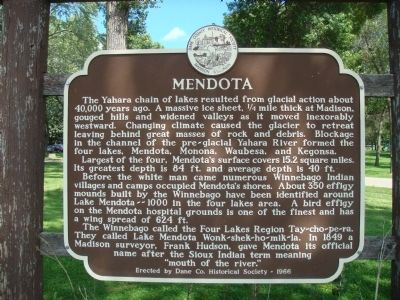
Mendota
Largest of the four, Mendota's surface covers 15.2 square miles. Its greatest depth is 84 ft. and average depth is 40 ft.
Before the white man came numerous Winnebago Indian villages and camps occupied Mendota's shores. About 350 effigy mounds built by the Winnebago have been identified around Lake Mendota -- 1000 in the four lakes area. A bird effigy on the Mendota hospital grounds is one of the finest and has a wing spread of 624 ft.
The Winnebago called the Four Lakes Region Tay-cho-pe-ra. They called Lake Mendota Wonk-shek-ho-mik-la. In 1849 a Madison surveyor, Frank Hudson, gave Mendota its official name after the Sioux Indian term meaning "mouth of the river."
Erected 1966 by the Dane County Historical Society. (Marker Number 8.)
Topics and series. This historical marker is listed in this topic list: Natural Features . In addition, it is included in the Wisconsin, Dane County Historical Society series list.
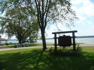
Location. 43° 6.523′ N, 89° 28.196′ W. Marker is in Middleton, Wisconsin, in Dane County. Marker can be reached from Century Avenue (County Road M) 0.1 miles east of County Road Q, on the right when traveling east. The marker is at the end of the road through Mendota Park near Lake Mendota. Touch for map. Marker is in this post office area: Middleton WI 53562, United States of America. Touch for directions.
Other nearby markers. At least 8 other markers are within 3 miles of this marker, measured as the crow flies. The Stamm House (approx. 1.3 miles away); Thorstrand (approx. 1.3 miles away); Pheasant Branch Encampment (approx. 1.4 miles away); Early Social Whirl (approx. 1½ miles away); Hickory Hill House (approx. 1.6 miles away); Hocheera (approx. 1.9 miles away); Blackhawk Country Club Mound Group (approx. 2 miles away); The Lemcke Farm House (approx. 2.2 miles away). Touch for a list and map of all markers in Middleton.
Credits. This page was last revised on August 12, 2021. It was originally submitted on August 29, 2010, by William J. Toman of Green Lake, Wisconsin. This page has been viewed 1,018 times since then and 38 times this year. Photos: 1. submitted on August 29, 2010, by William J. Toman of Green Lake, Wisconsin. 2. submitted on August 30, 2010, by William J. Toman of Green Lake, Wisconsin. • Bill Pfingsten was the editor who published this page.

