Marker Logo HMdb.org THE HISTORICAL
MARKER DATABASE
“Bite-Size Bits of Local, National, and Global History”
Capitol Hill in Salt Lake City in Salt Lake County, Utah — The American Mountains (Southwest)
 

Council Hall

Utah Historic Site

— National Register of Historic Places —


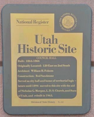
Council Hall Marker image. Click for full size.
Photographed By Bryan R. Bauer, August 27, 2010
1. Council Hall Marker
Inscription. Built: 1864 – 1866. Originally Located: 120 East on 2nd South. Architect: William H. Folsom. Construction: Red Sandstone. Served as city hall and home of territorial legislature until 1894, moved to this site with the aid of Nicholas G. Morgan, L.D.S. Church, and State of Utah, and rebuilt in 1963.
 
Erected by Division of State History. (Marker Number N-32.)
 
Topics. This historical marker is listed in this topic list: Notable Buildings. A significant historical year for this entry is 1864.
 
Location. 40° 46.539′ N, 111° 53.266′ W. Marker is in Salt Lake City, Utah, in Salt Lake County. It is in Capitol Hill. Marker is on 300 North east of State Street, on the right when traveling east. Marker is mounted on the building. Touch for map. Marker is at or near this postal address: 300 N State Street, Salt Lake City UT 84103, United States of America. Touch for directions.
 
Other nearby markers. At least 8 other markers are within walking distance of this marker. Old City Hall (a few steps from this marker); The 18th Ward Chapel (about 300 feet away, measured in a direct line); The Mormon Battalion (about 300 feet away); Ottinger Hall (about 600 feet away); Statue of Massassoit (about 700 feet away); Lest We Forget (about 800 feet away); Ensign Peak (about 800 feet away); The Constitution Revered (approx. 0.2 miles away). Touch for a list and map of all markers in Salt Lake City.
Paid Advertisement
Click on the ad for more information.
Please report objectionable advertising to the Editor.
Click or scan to see
this page online
 
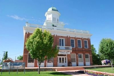
Council Hall and Marker image. Click for full size.
Photographed By Dawn Bowen, June 18, 2007
2. Council Hall and Marker
Old City Hall Timeline image. Click for full size.
Photographed By Bryan R. Bauer, August 27, 2010
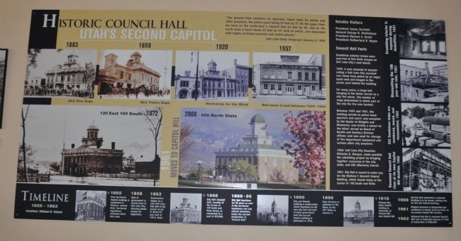
3. Old City Hall Timeline
This timeline shows the many varied uses of this building over its lifetime.
One of Two Bison on the Grounds image. Click for full size.
Photographed By Bryan R. Bauer, August 27, 2010
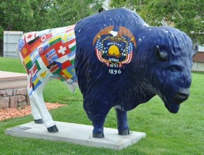
4. One of Two Bison on the Grounds
This bison has flags respresenting many of the countries whose immigrants contributed to the economic growth of Utah in the last half of the 19th century.
The "Suitcase" Bison image. Click for full size.
Photographed By Bryan R. Bauer, August 27, 2010
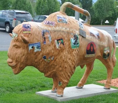
5. The "Suitcase" Bison
This representation of a bison-shaped piece of luggage bears souvenir stickers from many of Utah's scenic attractions.
Across the street image. Click for full size.
Photographed By Craig Baker (CC0), April 14, 2019
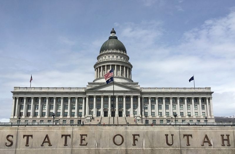
6. Across the street
 
 
Credits. This page was last revised on May 13, 2023. It was originally submitted on August 30, 2010, by Bryan R. Bauer of Kearns, Ut 84118. This page has been viewed 904 times since then and 13 times this year. Photos:   1. submitted on August 28, 2010, by Bryan R. Bauer of Kearns, Ut 84118.   2. submitted on June 25, 2007, by Dawn Bowen of Fredericksburg, Virginia.   3, 4, 5. submitted on August 28, 2010, by Bryan R. Bauer of Kearns, Ut 84118.   6. submitted on April 15, 2019, by Craig Baker of Sylmar, California. • Kevin W. was the editor who published this page.
Share this page.  
Share on Tumblr
m=35075

CeraNet Cloud Computing sponsors the Historical Marker Database.
This website earns income from purchases you make after using our links to Amazon.com. We appreciate your support.
Paid Advertisement
Apr. 24, 2024