Near Fredericksburg in Spotsylvania County, Virginia — The American South (Mid-Atlantic)
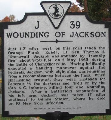
Wounding of Jackson
Erected 1997 by Department of Historic Resources. (Marker Number J-39.)
Topics and series. This historical marker is listed in this topic list: War, US Civil. In addition, it is included in the Virginia Department of Historic Resources (DHR) series list. A significant historical date for this entry is May 2, 1863.
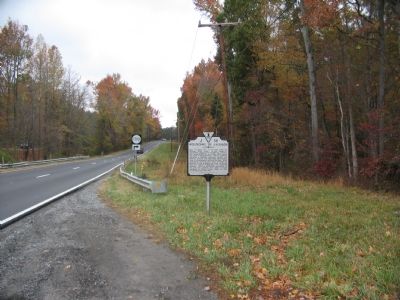
Location. 38° 18.289′ N, 77° 37.36′ W. Marker is near Fredericksburg, Virginia, in Spotsylvania County. Marker is at the intersection of Plank Road / Germania Highway (State Highway 3) and Nine Mile Run Road (County Route 1790), on the right when traveling west on Plank Road / Germania Highway. Touch for map . Marker is at or near this postal address: 1000 9 Mile Run Dr, Fredericksburg VA 22407, United States of America. Touch for directions.
Other nearby markers. At least 8 other markers are within walking distance of this marker. McLaws Trail (approx. half a mile away); Union Earthworks (approx. half a mile away); First Day at Chancellorsville (approx. half a mile away); Chancellorsville Campaign (approx. 0.6 miles away); a different marker also named Chancellorsville Campaign (approx. 0.6 miles away); a different marker also named Chancellorsville Campaign (approx. 0.6 miles away); a different marker also named First Day at Chancellorsville (approx. 0.6 miles away); a different marker also named First Day at Chancellorsville (approx. 0.6 miles away). Touch for a list and map of all markers in Fredericksburg.
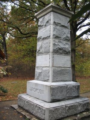
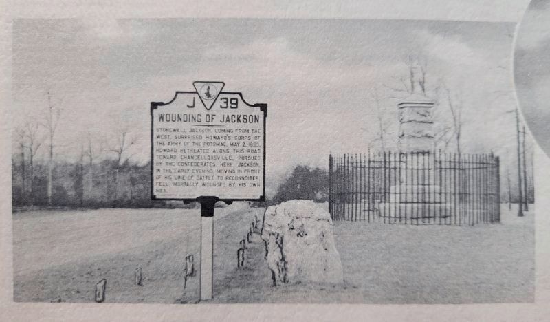
Regarding Wounding of Jackson. This marker replaced a previous J-39 also titled "Wounding of Jackson" but which stood to the west of the Chancellorsville intersection (with Ely's Ford Road), at the present day visitors center next to the Jackson Monument. The original was removed in the 1980s with the widening of Virginia Highway 3. It read, Stonewall Jackson, coming from the west, surprised Howard's Corps of the Army of the Potomac, May 2, 1863. Howard retreated along this road toward Chancellorsville, pursued by the Confederates. Here, Jackson, in the early evening, moving in front of his line of battle to reconnoitre, fell, mortally wounded by his own men.
This marker is grouped with those along McLaws Drive, Furnace Road, Sickles Drive, and East Jackson Trail, on the east side of the battlefield. See the McLaws's Line to Catharine Furnace Virtual Tour by Markers in the links section for a listing of related markers on the tour.
Also see . . .
1. Narrative of Events Surrounding the Wounding of Jackson. by Major Marcellus N. Moorman, Stuart Horse Artillery, Cavalry Corps, Army of Northern Virginia, based on his recollections and diaries. (Submitted on November 12, 2007, by Craig Swain of Leesburg, Virginia.)
2. Wounding of Jackson Trail. Walking tour around the site of the incident, near the park visitors center. (Submitted on November 12, 2007, by Craig Swain of Leesburg, Virginia.)
3. Marker's Old Location. The old marker stood near the Jackson Monument at the Chancellorville park visitors center. Note the different text narrative and the monument in the background of the photo from Civil War Album. (Submitted on January 18, 2008, by Craig Swain of Leesburg, Virginia.)
4. Marker Dedication. (Submitted on November 12, 2007, by Craig Swain of Leesburg, Virginia.)
5. McLaws's Line to Catharine Furnace Virtual Tour by Markers. Spread across a two mile
segment on the east side of the battlefield, this virtual tour by markers covers action from May 1-3, 1863. (Submitted on November 18, 2007, by Craig Swain of Leesburg, Virginia.)
Credits. This page was last revised on February 2, 2023. It was originally submitted on November 12, 2007, by Craig Swain of Leesburg, Virginia. This page has been viewed 1,778 times since then and 57 times this year. Photos: 1, 2, 3. submitted on November 12, 2007, by Craig Swain of Leesburg, Virginia. 4. submitted on November 7, 2021, by Kevin W. of Stafford, Virginia.


