Huntsville in Madison County, Alabama — The American South (East South Central)
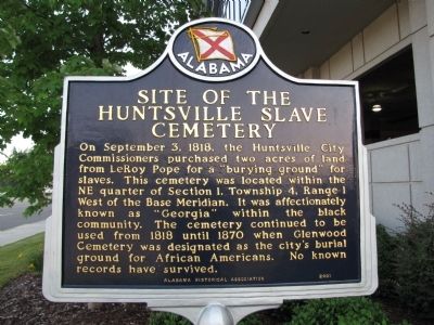
Site of the Huntsville Slave Cemetery
Erected 2001 by Alabama Historical Association.
Topics and series. This historical marker is listed in these topic lists: African Americans • Cemeteries & Burial Sites. In addition, it is included in the Alabama Historical Association series list. A significant historical month for this entry is September 1861.
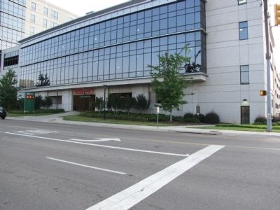
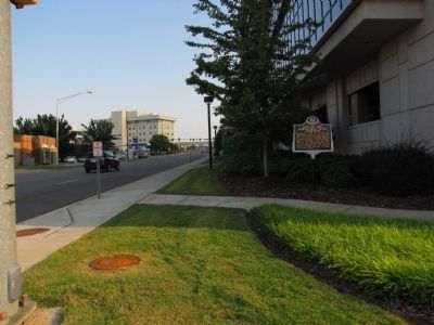
Location. 34° 43.339′ N, 86° 34.831′ W. Marker is in Huntsville, Alabama, in Madison County. Marker is at the intersection of Madison Street and St. Clair Avenue, on the right when traveling south on Madison Street. Touch for map. Marker is in this post office area: Huntsville AL 35801, United States of America. Touch for directions.
Other nearby markers. At least 8 other markers are within walking distance of this marker. Fifth Avenue School (approx. 0.2 miles away); Birthplace of General Morgan (approx. 0.3 miles away); Saint Bartley Primitive Baptist Church (approx. 0.4 miles away); Twickenham Historic District (approx. 0.4 miles away); First Baptist Church Huntsville, Alabama (approx. 0.4 miles away); The Public Inn (approx. half a mile away); Huntsville's First Black Women Voters (approx. half a mile away); William Hooper Councill High School Site (approx. half a mile away). Touch for a list and map of all markers in Huntsville.
Credits. This page was last revised on June 16, 2016. It was originally submitted on August 27, 2010, by Lee Hattabaugh of Capshaw, Alabama. This page has been viewed 3,813 times since then and 118 times this year. Last updated on September 2, 2010, by William J. Toman of Green Lake, Wisconsin. Photos: 1, 2, 3. submitted on August 27, 2010, by Lee Hattabaugh of Capshaw, Alabama. • Bill Pfingsten was the editor who published this page.


