Boca Chica in Cameron County, Texas — The American South (West South Central)
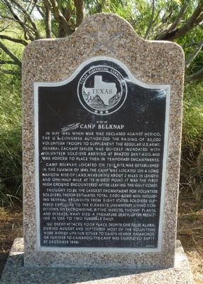
Site of Camp Belknap
In May 1846 when war was declared against Mexico, the U.S. Congress authorized the raising of 50,000 volunteer troops to supplement the regular U.S. Army. General Zachary Taylor was quickly inundated with volunteer soldiers arriving at Brazos Santiago, and was forced to place them in temporary encampments.
Camp Belknap, located on this site, was established in the summer of 1846. The camp was located on a long narrow rise of land, measuring about 2 miles in length and one-half mile at its widest point. It was the first high ground encountered after leaving the Gulf Coast.
Thought to be the largest encampment for volunteer soldiers, troop estimates total 7,000-8,000 men including several regiments from eight states. Soldiers suffered exposure to the elements, unsanitary living conditions, overcrowding, biting insects, thorny plants, and disease. Many died a premature death, often resulting in one to two funerals daily.
No enemy attacks took place despite one false alarm. During August and September most of the volunteers were moved upriver either to camps nearer Matamoros, or further to Camargo. The camp was completely empty by December 1846.
Erected 1996 by Texas Historical Commission. (Marker Number 4739.)
Topics and series. This historical marker is listed in this topic list: War, Mexican-American. In addition, it is included in the Former U.S. Presidents: #12 Zachary Taylor series list. A significant historical month for this entry is May 1846.
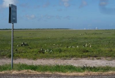
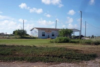
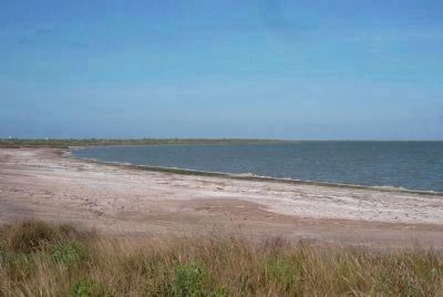
Location. 25° 57.805′ N, 97° 13.799′ W. Marker is in Boca Chica, Texas, in Cameron County. Marker is on Boca Chica Boulevard (State Highway 4) 0.1 miles west of Quicksilver Avenue. Marker is across the dunes from South Bay on the north. It is south and west of Boca Chica State Park and Brazos Island State Park, approximately 16 miles east of Brownsville and just north of the U.S. - Mexican border. Touch for map. Marker is at or near this postal address: Boca Chica Boulevard, Brownsville TX 78521, United States of America. Touch for directions.
Other nearby markers. At least 8 other markers are within 5 miles of this marker, measured as the crow flies. Palmito Ranch Battlefield: Last Clash of the Blue and the Gray (approx. 4.4 miles away); Exploring The Boundaries (approx. 4.4 miles away); Battle of Palmito Ranch (approx. 4˝ miles away); The High Price of Cotton (approx. 4.6 miles away); a different marker also named The Battle of Palmito Ranch (approx. 4.6 miles away); Last Battle of the Civil War (approx. 4.6 miles away); Divided Loyalties: Hispanics in the Civil War (approx. 4.6 miles away); Palmetto Piling (approx. 5 miles away).
Also see . . .
1. Boca Chica, Texas. Wikipedia entry (Submitted on September 4, 2010, by Richard E. Miller of Oxon Hill, Maryland.)
2. Boca Chica, Texas. Texas Escapes website entry (Submitted on September 4, 2010, by Richard E. Miller of Oxon Hill, Maryland.)
3. Brazos Island. Wikipedia entry (Submitted on September 4, 2010, by Richard E. Miller of Oxon Hill, Maryland.)
Additional commentary.
1. Los Brazos de Santiago
This was the only naturally occuring deep water harbor anywhere in the Western Gulf of Mexico, that wasn't the mouth of a river. It had been the Port of Matamoros, the scene of naval actions by the Texas Navy in 1836, against the Mexican navy. It was first discovered by Alonso Pineda in 1519, but remained a well kept military secret, and never appeared on any Spanish navigational charts, until much later. To this day, no one knows who gave it the name, Los Brazos de Santiago, which, to a mariner means, "an arm of the deep sea."
— Submitted February 25, 2012, by Joseph P. Linck of Brownsville, Texas.
Credits. This page was last revised on April 23, 2021. It was originally submitted on September 4, 2010, by Richard E. Miller of Oxon Hill, Maryland. This page has been viewed 1,846 times since then and 108 times this year. Photos: 1, 2, 3, 4. submitted on September 4, 2010, by Richard E. Miller of Oxon Hill, Maryland. • Bill Pfingsten was the editor who published this page.


