Near Camden in Knox County, Maine — The American Northeast (New England)
Mount Battie Memorial Tower
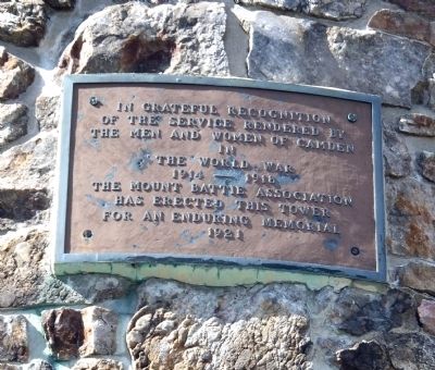
Photographed by Roger W. Sinnott, September 5, 2010
1. Mount Battie Memorial Tower Marker
Erected 1921 by The Mount Battie Association.
Topics. This memorial is listed in this topic list: War, World I.
Location. 44° 13.367′ N, 69° 4.152′ W. Memorial is near Camden, Maine, in Knox County. It can be reached from Mount Battie Road. Marker is on the side of the tower. Marker is on the summit of Mount Battie, at the high end of Mount Battie Road. Touch for map. Memorial is in this post office area: Camden ME 04843, United States of America. Touch for directions.

Regionally, this memorial is in Midcoast Maine and on Penobscot Bay. It is also in the American Northeast, in New England, and on the Eastern Seaboard. Globally, it is in the North Atlantic Region, North America, the Western Hemisphere, the Western World, and the Anglosphere.
Other nearby markers. At least 8 other markers are within 5 miles of this marker, measured as the crow flies: Edna St. Vincent Millay
this page online
Regarding Mount Battie Memorial Tower. This stone tower offers a spectacular view of Camden harbor. When erected in 1921, it replaced a hotel that had stood atop 787-foot Mount Battie. The tower is accessible by paved road, and there are many hiking trails in the area.
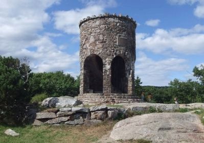
Photographed by Roger W. Sinnott, September 5, 2010
2. The Tower with Marker
Credits. This page was last revised on September 23, 2020. It was originally submitted on September 7, 2010, by Roger W. Sinnott of Norwell, Massachusetts. This page has been viewed 2,824 times since then and 54 times this year. Photos: 1, 2. submitted on September 7, 2010, by Roger W. Sinnott of Norwell, Massachusetts. • Syd Whittle was the editor who published this page.
