Prairie Grove in Washington County, Arkansas — The American South (West South Central)
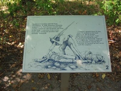
29th Arkansas Infantry
"I stopped, squatted down by him, and laid my hand on his head and I said, 'Oh my brother whare [sic] are you hurt?' I saw that he was breathing his last...It almost run me distracted. I did not know what to do. I knew I could not do him any good by staying there with him, so I jumped up and run on with the company." (Marker Number 2.)
Topics. This historical marker is listed in this topic list: War, US Civil.
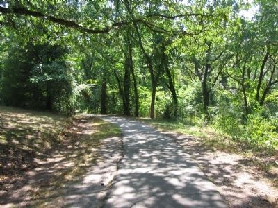
Location. 35° 59.099′ N, 94° 18.361′ W. Marker is in Prairie Grove, Arkansas, in Washington County. Marker can be reached from Park Tour Road, on the right when traveling east. Located on the walking trail near stop four, the Borden House, of Prairie Grove Battlefield State Park. Touch for map. Marker is in this post office area: Prairie Grove AR 72753, United States of America. Touch for directions.
Other nearby markers. At least 8 other markers are within walking distance of this marker. The Dead of Prairie Grove (about 300 feet away, measured in a direct line); Herron's Attack (about 400 feet away); Lieutenant Colonel John C. Black (about 400 feet away); Blocher's Arkansas Battery (about 400 feet away); The Borden House / The Legacy of Prairie Grove (about 400 feet away); Archibald Borden House (about 500 feet away); 26th Indiana and 37th Illinois Infantry (about 600 feet away); The Lord's Vineyard (approx. 0.2 miles away). Touch for a list and map of all markers in Prairie Grove.
Also see . . . Prairie Grove Battlefield State Park. (Submitted on September 7, 2010, by Craig Swain of Leesburg, Virginia.)
Credits. This page was last revised on June 16, 2016. It was originally submitted on September 7, 2010, by Craig Swain of Leesburg, Virginia. This page has been viewed 919 times since then and 19 times this year. Photos: 1, 2. submitted on September 7, 2010, by Craig Swain of Leesburg, Virginia.

