Near Monticello in Jasper County, Georgia — The American South (South Atlantic)
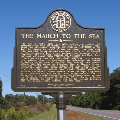
The March to the Sea
The Right Wing (15th and 17th Corps), Maj. Gen. O. O. Howard, USA, marched south via Stockbridge and McDonough and camped at Jackson on the night of the 17th. Next morning, two pontoon bridges were laid across the Ocmulgee River at Planters’ Factory (Ocmulgee Mills) near Seven Islands (12 miles SW). At one o’clock the Right Wing began its crossing into Jasper County.
The 15th Corps (Osterhaus), less Corse’s division, moved via Hillsboro (10 miles S) toward Gordon, where the Right Wing would be in communication with the Left Wing at Milledgeville. The 17th Corps (Blair), to relieve congestion on the Hillsboro road, marched via Monticello and Blountsville (8 miles NW of Gray) to Gordon. Corse’s division, the last to cross, and the 1st Missouri Engineers with the pontoon train, followed the 17th Corps.
Erected 2010 by Georgia Historical Society. (Marker Number 079-9.)
Topics and series. This historical marker is listed in this topic list: War, US Civil. In addition, it is included in the Georgia Historical Society, and the Sherman’s March to the Sea series lists. A significant historical month for this entry is October 1896.
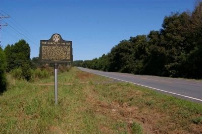
Location. 33° 18.733′ N, 83° 44.8′ W. Marker is near Monticello, Georgia, in Jasper County. Marker is at the intersection of Georgia Route 16 and Buggy Road (County Route 170), on the right when traveling east on State Route 16. Touch for map. Marker is in this post office area: Monticello GA 31064, United States of America. Touch for directions.
Other nearby markers. At least 8 other markers are within 5 miles of this marker, measured as the crow flies. Jackson Springs (approx. 2.8 miles away); Monticello Government Complex (approx. 3.6 miles away); Jasper County Civil War Memorial (approx. 3.7 miles away); Jasper County (approx. 3.7 miles away); Site of Inn (approx. 3.7 miles away); Reese Home (approx. 3.9 miles away); The Isaac Parker Inn (approx. 4˝ miles away); The Stoneman Raid (approx. 5 miles away). Touch for a list and map of all markers in Monticello.
More about this marker. This marker replaced an earlier marker of the same title and text erected by the Georgia Historical Commission in 1957, which had disappeared.
Credits. This page was last revised on June 16, 2016. It was originally submitted on September 7, 2010, by David Seibert of Sandy Springs, Georgia. This page has been viewed 1,378 times since then and 30 times this year. Photos: 1, 2, 3, 4. submitted on September 7, 2010, by David Seibert of Sandy Springs, Georgia. • Craig Swain was the editor who published this page.


