Berea in Cuyahoga County, Ohio — The American Midwest (Great Lakes)
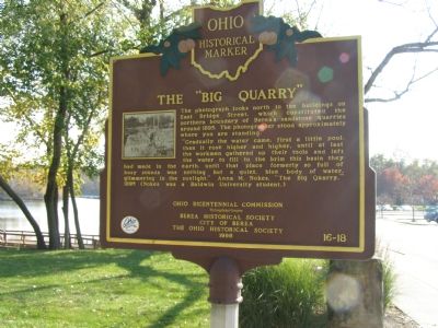
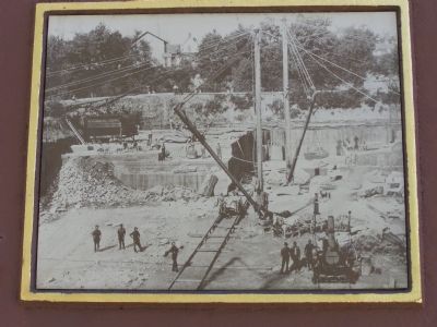
The “Big Quarry”
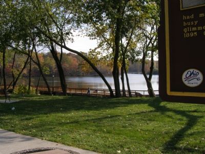
“Gradually the water came, first a little pool, then it rose higher and higher, until at last the workmen gathered up their tools an left the water to fill to the brim this basin they had made in the earth, until that place formerly so full of busy sounds was nothing but a quiet, blue body of water, glimmering in the sunlight.” Anna M. Nokes. “The Big Quarry,” 1895 (Nokes was a Baldwin University student.)
Erected 1998 by Ohio Bicentennial Commission, The Longaberger Company, Berea Historical Society, City of Berea, The Ohio Historical Society. (Marker Number 16-18.)
Topics and series. This historical marker is listed in these topic lists: Arts, Letters, Music • Industry & Commerce. In addition, it is included in the Ohio Historical Society / The Ohio History Connection series list. A significant historical year for this entry is 1895.
Location. 41° 21.925′ N, 81° 51.099′ W. Marker is in Berea, Ohio, in Cuyahoga County. Marker is on Berea Commons. Touch for map. Marker is in this post office area: Berea OH 44017, United States of America. Touch for directions.
Other nearby markers. At least 8 other markers are within walking distance of this marker. Berea Sandstone Quarries (here, next to this marker); The Berea Triangle (about 600 feet away, measured in a direct line); First Congregational United Church of Christ of Berea (approx. 0.2 miles away); Lyceum Square (approx. 0.2 miles away); Adams Street Cemetery (approx. ¼ mile away); Ogilvy Chapel of St. Thomas Episcopal Church (approx. half a mile away); Baldwin University (approx. 0.6 miles away); Berea District Seven School (approx. ¾ mile away). Touch for a list and map of all markers in Berea.
Also see . . . Entry on Berea Sandstone at Ohio History Central. (Submitted on April 20, 2009, by Christopher Busta-Peck of Shaker Heights, Ohio.)
Credits. This page was last revised on January 20, 2020. It was originally submitted on November 14, 2007, by Christopher Light of Valparaiso, Indiana. This page has been viewed 2,607 times since then and 38 times this year. Photos: 1, 2, 3, 4. submitted on November 14, 2007, by Christopher Light of Valparaiso, Indiana. • J. J. Prats was the editor who published this page.


