Near Oconee in Washington County, Georgia — The American South (South Atlantic)
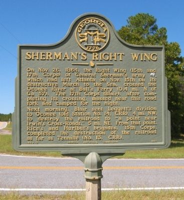
Sherman's Right Wing
Next morning, Blair sent Leggett’s division to Oconee (old Station No. 14, CRR), 4 mi. NW, to destroy the railroad to “a point near Irwin’s Cross~Roads,” 5 mi. NE. From that point, Rice’s and Hurlbut’s brigades, 15th Corps, completed the destruction of the railroad as far as Tennille (No.13, CRR).
Erected 1957 by Georgia Historical Commission. (Marker Number 150-12.)
Topics and series. This historical marker is listed in this topic list: War, US Civil. In addition, it is included in the Georgia Historical Society, and the Sherman’s March to the Sea series lists. A significant historical date for this entry is October 26, 1864.
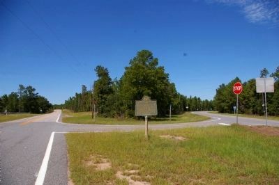
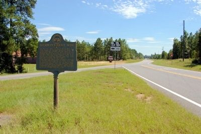
Location. 32° 48.454′ N, 82° 54.798′ W. Marker is near Oconee, Georgia, in Washington County. Marker is at the intersection of Georgia Route 68 and Georgia Route 272, on the left when traveling north on State Route 68. Touch for map. Marker is in this post office area: Oconee GA 31067, United States of America. Touch for directions.
Other nearby markers. At least 8 other markers are within 7 miles of this marker, measured as the crow flies. Jefferson Davis (approx. 2.1 miles away); Ball's Ferry (approx. 2.6 miles away); a different marker also named Ball's Ferry (approx. 3.1 miles away); The Defense of Ball's Ferry (approx. 3.1 miles away); a different marker also named Ball's Ferry (approx. 3.4 miles away); The Defense of the Oconee Bridge (approx. 4 miles away); Irwin’s Crossroad (approx. 5 miles away); Jared Irwin (approx. 6.8 miles away). Touch for a list and map of all markers in Oconee.
Credits. This page was last revised on June 16, 2016. It was originally submitted on September 9, 2010, by David Seibert of Sandy Springs, Georgia. This page has been viewed 1,247 times since then and 17 times this year. Photos: 1, 2, 3. submitted on September 9, 2010, by David Seibert of Sandy Springs, Georgia. • Craig Swain was the editor who published this page.


