Near Garfield in Benton County, Arkansas — The American South (West South Central)
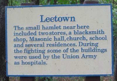
Leetown
The small hamlet near here included two stores, a blacksmith shop, Masonic hall, church, school and several residences. During the fighting some of the buildings were used by the Union Army as hospitals.
Topics. This historical marker is listed in this topic list: War, US Civil.
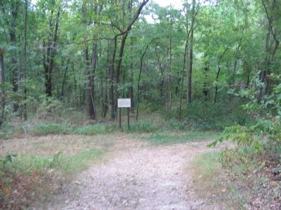
Location. 36° 26.431′ N, 94° 3.055′ W. Marker is near Garfield, Arkansas, in Benton County. Marker can be reached from Military Park Road (County Road 65), on the left when traveling west. Located a short distance from stop three, Leetown, on the driving tour of Pea Ridge National Military Park. Touch for map. Marker is in this post office area: Garfield AR 72732, United States of America. Touch for directions.
Other nearby markers. At least 8 other markers are within one mile of this marker, measured as the crow flies. A Village Full of Wounded Men (within shouting distance of this marker); A Fierce Tangle in Morgan's Woods (approx. ¼ mile away); Stand to Your Posts! (approx. 0.3 miles away); A Crisis in Command (approx. 0.3 miles away); Save the Cannon! (approx. 0.3 miles away); Two Armies Collide (approx. 0.9 miles away); Getting Ready To Fight (approx. one mile away); City of Soldiers (approx. one mile away). Touch for a list and map of all markers in Garfield.
Also see . . .
1. Pea Ridge National Military Park. National Park Service website entry (Submitted on September 9, 2010, by Craig Swain of Leesburg, Virginia.)
2. Pea Ridge (Elkhorn Tavern). American Battlefield Trust website entry (Submitted on May 8, 2021, by Larry Gertner of New York, New York.)
Credits. This page was last revised on May 8, 2021. It was originally submitted on September 9, 2010, by Craig Swain of Leesburg, Virginia. This page has been viewed 1,125 times since then and 24 times this year. Photos: 1, 2, 3. submitted on September 9, 2010, by Craig Swain of Leesburg, Virginia.


