West Jordan in Salt Lake County, Utah — The American Mountains (Southwest)
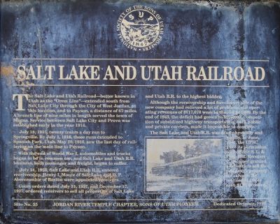
Salt Lake and Utah Railroad
July 18, 1915, twenty trains a day ran to Springville. By July 1, 1916, these runs extended to Spanish Fork, Utah. May 20, 1916, saw the last day of rail-laying on the main line to Payson.
With the end of World War I, automobiles and trucks began to be in common use, and Salt Lake and Utah R.R. business, both passenger and freight, began to suffer.
July 24, 1925, Salt Lake and Utah R.R. entered receivership. Henry I. Moore of Salt Lake and D. P. Abercrombie of Boston were appointed receivers.
Court orders dated July 31, 1937, and December 17, 1937, ordered receivers to sell all property of Salt Lake and Utah R.R. to the highest bidder.
Although the receiveship and foreclosure sale of the new company had relieved a lot of problems, the operating revenues of $717,678 were in the red $44,489. By the end of 1945, the deficit had grown to $220,600. Competition of subsidized highway transportation, both public and private carriers, made it impossible to compete.
The Salt Lake and Utah R.R. was dead physically and legally. In June, 1946, the UPSC gave its permission to abandon S.L. & Utah R.R. Receiver J. Quinney granted authority to sell the company's property for salvage. He realized $1.10 for each $1.00 invested.
Erected 1990 by Sons of Utah Pioneers - Jordan River Temple Chapter. (Marker Number 35.)
Topics and series. This historical marker is listed in this topic list: Railroads & Streetcars. In addition, it is included in the Sons of Utah Pioneers series list. A significant historical month for this entry is May 1849.
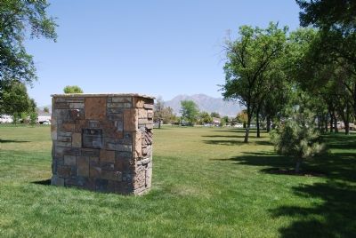
Location. 40° 36.418′ N, 111° 56.577′ W. Marker is in West Jordan, Utah, in Salt Lake County. Marker is on 1825 West (State Highway 48) 0.1 miles south of 7800 South (State Highway 48), on the right when traveling south. Located in the Veteran’s Memorial Park west of City Hall; northwest of the children's play structure and the pavilion; southeast of the ball fields. Best access to the marker is via 1825 West off of 7800 South. Touch for map. Marker is in this post office area: West Jordan UT 84088, United States of America. Touch for directions.
Other nearby markers. At least 8 other markers are within 3 miles of this marker, measured as the crow flies. Utah Idaho Sugar Factory (here, next to this marker); West Jordan Pioneer Church (approx. 0.9 miles away); West Jordan (approx. 0.9 miles away); West Jordan Industry (approx. one mile away); West Jordan Settlement (approx. one mile away); North Jordan Canal (approx. one mile away); The Old School House (approx. 2.2 miles away); Traders Rest (approx. 2.9 miles away). Touch for a list and map of all markers in West Jordan.
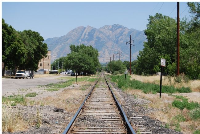
Regarding Salt Lake and Utah Railroad. This railroad was an electric interurban line. —Ed. And will soon be getting a new lease on life as the TRAX electric interurban line.
Credits. This page was last revised on June 16, 2016. It was originally submitted on June 27, 2007, by Dawn Bowen of Fredericksburg, Virginia. This page has been viewed 2,592 times since then and 22 times this year. Last updated on September 10, 2010, by Bryan R. Bauer of Kearns, Ut 84118. Photos: 1, 2, 3. submitted on June 27, 2007, by Dawn Bowen of Fredericksburg, Virginia. • Kevin W. was the editor who published this page.


