Near Garfield in Benton County, Arkansas — The American South (West South Central)
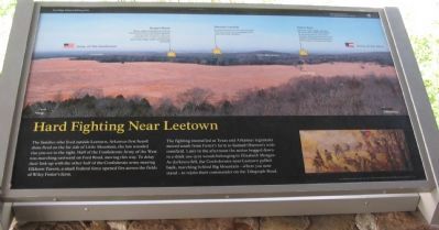
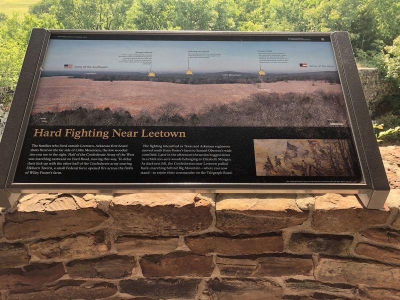
Hard Fighting Near Leetown
Pea Ridge National Military Park
— National Park Service, U.S. Department of the Interior —
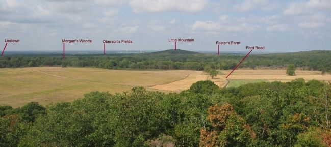
The families who lived outside Leetown, Arkansas first heard shots fired on the far side of Little Mountain, the low wooded rise you see to the right. Half of the Confederate Army of the West was marching eastward on Ford Road, moving this way. To delay their link-up with the other half of the Confederate army nearing Elkhorn Tavern, a small Federal force opened fire across the fields of Wiley Foster's farm.
The fighting intensified as Texas and Arkansas regiments moved south from Foster's farm to Samuel Oberson's wide cornfield. Later in the afternoon the action bogged down in a thick 100-acre woods belonging to Elizabeth Morgan. As darkness fell, the Confederates near Leetown pulled back, marching behind Big Mountain - where you now stand - to rejoin their commander on the Telegraph Road.
Erected by National Park Service, U.S. Department of the Interior.
Topics. This historical marker is listed in this topic list: War, US Civil.
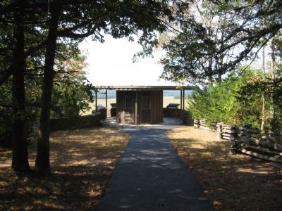
Location. 36° 27.253′ N, 94° 1.378′ W. Marker is near Garfield, Arkansas, in Benton County. Marker can be reached from Military Park Road (County Road 65), on the right when traveling south. Located at a gazebo a short walk from stop seven, the East Overlook, on the driving tour of Pea Ridge National Military Park. Touch for map. Marker is in this post office area: Garfield AR 72732, United States of America. Touch for directions.
Other nearby markers. At least 8 other markers are within walking distance of this marker. Slaughter in the Rocks (here, next to this marker); It was the Grandest Thing I Ever Saw... (here, next to this marker); Night Moves (here, next to this marker); Fiery Finale on Ruddick's Field (a few steps from this marker); A Perfect Storm of Shot and Shell (approx. 0.3 miles away); Confederate Sunset (approx. 0.3 miles away); A Reunited Soldiery Monument (approx. 0.3 miles away); Pea Ridge Confederate Monument (approx. 0.4 miles away). Touch for a list and map of all markers in Garfield.
Also see . . .
1. Pea Ridge National Military Park. National Park Service website entry (Submitted on September 12, 2010, by Craig Swain of Leesburg, Virginia.)
2. The Battle of Pea Ridge. American Battlefield Trust website entry (Submitted on September 12, 2010, by Craig Swain of Leesburg, Virginia.)
Photographed By Craig Swain, August 30, 2010
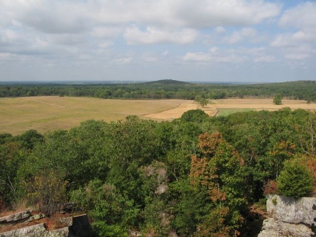
4. View of the Leetown Sector of the Battlefield
Looking southwest from the overlook. The prominent rise in the center of view is Little (or Round) Mountain. To the left (south) are the locations of Oberson's Field, Morgan's Woods, and Leetown. To the right (north) is the site of Foster's Farm.
Photographed By Craig Swain, August 30, 2010
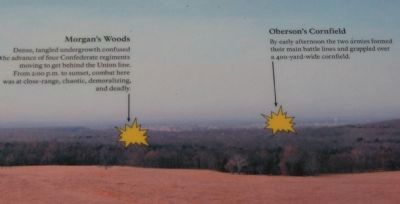
5. Notations for Morgan's Woods and Oberson's Fields
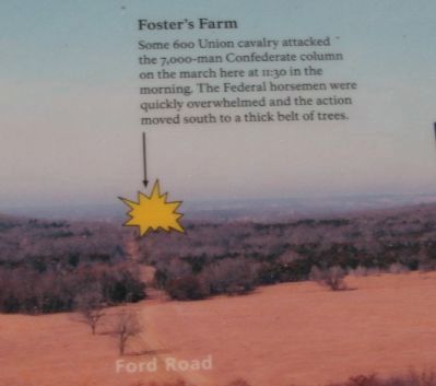
Morgan's Woods
Dense, tangled undergrowth, confused the advance of four Confederate regiments moving to get behind the Union line. From 2:00 p.m. to sunset, combat here was at close-range, chaotic, demoralizing, and deadly.
Oberson's Cornfield
By early afternoon the two armies formed their main battle lines and grappled over a 400-yard-wide cornfield.
Credits. This page was last revised on June 19, 2023. It was originally submitted on September 12, 2010, by Craig Swain of Leesburg, Virginia. This page has been viewed 1,156 times since then and 23 times this year. Photos: 1. submitted on September 12, 2010, by Craig Swain of Leesburg, Virginia. 2. submitted on June 4, 2023, by Duane and Tracy Marsteller of Murfreesboro, Tennessee. 3, 4, 5, 6, 7. submitted on September 12, 2010, by Craig Swain of Leesburg, Virginia.
