East Shore in New Haven in New Haven County, Connecticut — The American Northeast (New England)
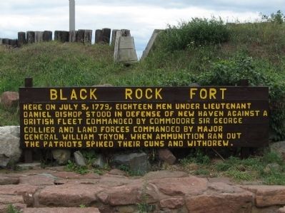
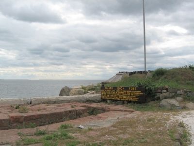
Black Rock Fort
Topics. This historical marker is listed in these topic lists: Forts and Castles • War, US Revolutionary. A significant historical date for this entry is July 5, 1779.
Location. 41° 16.229′ N, 72° 54.335′ W. Marker is in New Haven, Connecticut, in New Haven County. It is in East Shore. Marker can be reached from the intersection of Woodward Avenue and Pope Street, on the right when traveling south. Located in Black Rock Fort. Touch for map. Marker is in this post office area: East Haven CT 06512, United States of America. Touch for directions.
Other nearby markers. At least 8 other markers are within walking distance of this marker. Patriots of New Haven Memorial (a few steps from this marker); Society of The Cincinnati Memorial (about 300 feet away, measured in a direct line); The Oyster Industry in New Haven (about 500 feet away); In Honor of Captain Nathan Hale (about 700 feet away); Fort Nathan Hale (approx. ¼ mile away); In Memory of George Pardee (approx. 0.6 miles away); East Shore Park (approx. 0.6 miles away); Roll of Honor (approx. 0.8 miles away). Touch for a list and map of all markers in New Haven.
Regarding Black Rock Fort.
[ from the National Register of Historic Places Inventory Nomination Form ]
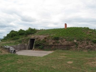
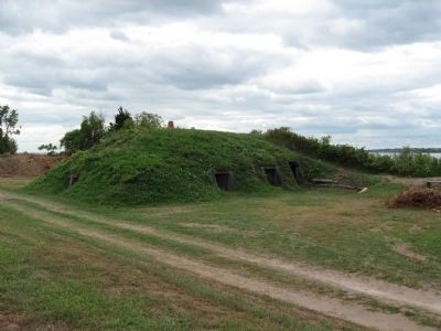
This site is presently occupied by a unique fort of the American Civil War period. On this same site in 1659, a earthworks and battery was erected to defend the New Haven Colony. In 1775, another works, a log and earthworks fort was erected for the revolution.
This fort was subjected to a combined land and naval attack by a large British force on July 5, 1779. The fort was then defended by nineteen embers of the local militia until ammunition ran out. Then the guns were spiked and the fort strategically evacuated. All of the defenders were taken prisoner as they were making their way through the lines. They had been cut off.
About 1806 the site was purchased by the Federal Gov't. for the creation of an elliptical shaped masonry fort to mount nine guns, and to construct a barracks to house fifty officers and men. This fort was manned by U.S. corps of Artillery during the War of 1812. On several occasions it served to drive off would be British raiding vessels. This fort was
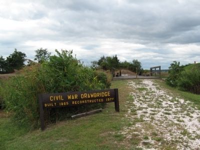
named in honor of Nathan Hale a martyred patriot. In 1863 work was begun on the second fort Hale. This fort was designed to mount 18 guns of heavy caliber. The work was completed in 1866, but the fort saw no action. For many years the fort was occupied and maintained as a post, but became outmoded. The armament was removed and the site, fort intact, was deeded to the State of Connecticut in 1921. Control of use of the site is presently vested in the City of New Haven, as a public park.
Also see . . .
1. Fort Nathan Hale on Wikipedia. (Submitted on September 14, 2010, by Michael Herrick of Southbury, Connecticut.)
2. Fort Nathan Hale and Black Rock Fort web site. (Submitted on September 14, 2010, by Michael Herrick of Southbury, Connecticut.)
Credits. This page was last revised on February 10, 2023. It was originally submitted on September 14, 2010, by Michael Herrick of Southbury, Connecticut. This page has been viewed 1,699 times since then and 57 times this year. Photos: 1, 2, 3, 4, 5, 6, 7, 8. submitted on September 14, 2010, by Michael Herrick of Southbury, Connecticut.
