Central City in Salt Lake City in Salt Lake County, Utah — The American Mountains (Southwest)
Trinity African Methodist Episcopal Church
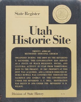
Photographed by Dawn Bowen, June 18, 2007
1. Trinity African Methodist Episcopal Church Marker
Erected by Utah State Historical Society. (Marker Number S-73.)
Topics and series. This historical marker is listed in these topic lists: African Americans • Religion & Religious Structures. In addition, it is included in the African Methodist Episcopal (AME) Church, and the Utah Historic Sites (NRHP) series lists. A significant historical year for this entry is 1907.
Location. 40° 45.389′ N, 111° 53.031′ W. Marker is in Salt Lake City, Utah, in Salt Lake County. It is in Central City. It is on Martin Luther King Boulevard, on the left when traveling east. Touch for map. Marker is at or near this postal address: 239 E 600 South, Salt Lake City UT 84111, United States of America.
this page online

Regionally, this marker is in the Wasatch Front and in Greater Salt Lake. It is also in the American Mountain West and on the Colorado Plateau. Globally, it is in North America, the Rocky Mountains, the Western Hemisphere, the Western World, and the Anglosphere. Historically, it finds itself in what was once New Spain and also Mexico’s Alta California.
Other nearby markers. At least 8 other markers are within walking distance of this marker: Salt Lake City and County Building (approx. ¼ mile away); Richmond Park (approx. 0.3 miles away); a different marker also named Salt Lake City and County Building (approx. 0.3 miles away); Pioneer Camping Grounds (approx. 0.3 miles away); Central Overland Trail - Washington Square (approx. 0.3 miles away); Congregation Montefiore (approx. 0.3 miles away); First Church of Christ, Scientist, Salt Lake City (approx. half a mile away); a different marker also named First Church of Christ, Scientist (approx. half a mile away). Touch for a list and map of all markers in Salt Lake City.
Another marker is no longer nearby. Salt Lake City & County Building (was approx.
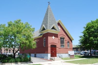
Photographed by Dawn Bowen, June 18, 2007
2. Trinity African Methodist Episcopal Church
Regarding Trinity African Methodist Episcopal Church. This location is on the National Register of Historic Places.
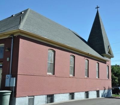
Photographed by Bryan R. Bauer, September 7, 2010
3. West Face of Trinity African Methodist Episcopal Church
Photographed by Dawn Bowen, June 18, 2007
4. Trinity African Methodist Episcopal Church Marker
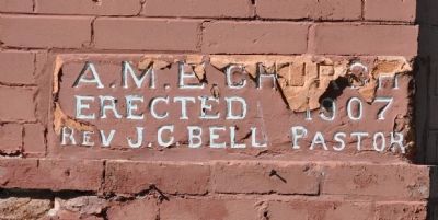
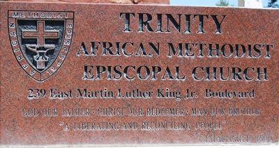
Photographed by Bryan R. Bauer, September 7, 2010
5. Trinity African Methodist Episcopal Church Cornerstone
Credits. This page was last revised on January 6, 2025. It was originally submitted on June 26, 2007, by Dawn Bowen of Fredericksburg, Virginia. This page has been viewed 2,395 times since then and 35 times this year. Last updated on September 17, 2010, by Bryan R. Bauer of Kearns, Ut 84118. Photos: 1, 2. submitted on June 26, 2007, by Dawn Bowen of Fredericksburg, Virginia. 3. submitted on September 17, 2010, by Bryan R. Bauer of Kearns, Ut 84118. 4. submitted on June 26, 2007, by Dawn Bowen of Fredericksburg, Virginia. 5. submitted on September 17, 2010, by Bryan R. Bauer of Kearns, Ut 84118. • Kevin W. was the editor who published this page.
