Lexington in Fayette County, Kentucky — The American South (East South Central)
Lexington Historic Distillery District
Inscription.
Side A
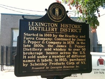
Started in 1869 by the Headley and Farra Company. Continued by James E. Pepper & Company in 1879. In the late 1800s, the James E. Pepper Distillery sold whiskey to over 90 brokerage houses across the U.S. It sold under a number of different names & labels. In 1933, purchased by Schenley Products Corp. of NY. Presented by Lexington Directions Inc.
Side B
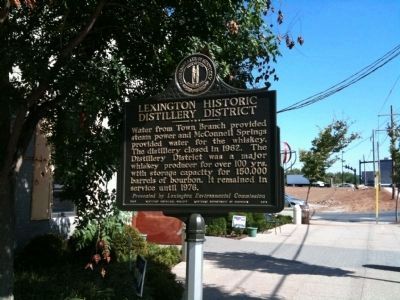
Water from Town Branch provided steam power and McConnell Springs provided water for the whiskey. The distillery closed in 1962. The Distillery District was a major whiskey producer for over 100 yrs. with storage capacity for 150,000 barrels of bourbon. It remained in service until 1976. Presented by Lexington Environmental Commission
Erected 2009 by Kentucky Historical Society. (Marker Number 2313.)
Topics and series. This historical marker is listed in this topic list: Industry & Commerce. In addition, it is included in the Kentucky Historical Society series list. A significant historical year for this entry is 1869.
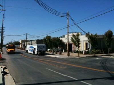
Location. 38° 3.169′ N, 84° 30.563′ W. Marker is in Lexington, Kentucky, in Fayette County. Marker is on Manchester Street, on the right when traveling west. Marker is in front of Buster's. Touch for map. Marker is at or near this postal address: 899 Manchester Street, Lexington KY 40508, United States of America. Touch for directions.
Other nearby markers. At least 8 other markers are within walking distance of this marker. Lexington Cemetery (approx. ¼ mile away); Historic Botherum (approx. ¼ mile away); Vertner Woodson Tandy (approx. ¼ mile away); Mary Desha (approx. 0.3 miles away); Fort Clay (approx. 0.3 miles away); Henry Clay (approx. 0.3 miles away); 1787-1987 Bicentennial Tree (approx. 0.3 miles away); Address by President Lincoln (approx. 0.4 miles away). Touch for a list and map of all markers in Lexington.
Credits. This page was last revised on June 16, 2016. It was originally submitted on September 17, 2010, by Matt Carter of Lexington, Kentucky. This page has been viewed 1,330 times since then and 28 times this year. Photos: 1, 2, 3. submitted on September 17, 2010, by Matt Carter of Lexington, Kentucky. • Bill Pfingsten was the editor who published this page.


