
Near Ewing in Lee County, Virginia — The American South (Mid-Atlantic)
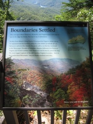
Boundaries Settled
Photographed by Craig Swain, September 5, 2010
1. Boundaries Settled Marker
In 1665 Great Britain's King Charles II declared his Virginia colony was to be separated from his Carolina colony by a line drawn at latitude 36° 30'. Surveyors started at the Atlantic Ocean in 1728 to run the line westward to the Mississippi. Decades of boundary disputes followed, first between Virginia and North Carolina. Later Tennessee and Kentucky joined the fray. The most rugged segment of the old Carolina-Virginia boundary - here in the Cumberland Mountains - was not finally resolved until 1803.
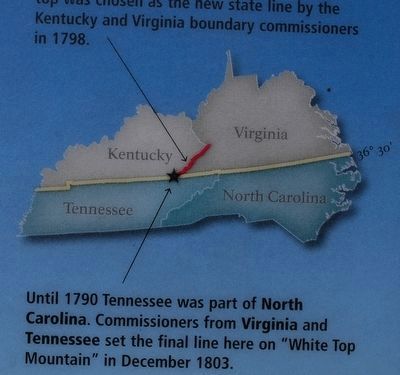
Before 1792 Kentucky was the westernmost county of Virginia. The Cumberland ridge top was chosen as the new state line by the Kentucky and Virginia boundary commissioners in 1798.
Until 1790 Tennessee was part of North Carolina. Commissioners from Virginia and Tennessee set the final line here on "White Top Mountain" in December 1803.
Here, you are in Virginia.
Erected by Cumberland Gap National Historical Park - National Park Service - Department of the Interior.
Topics. This historical
this page online
Location. 36° 36.341′ N, 83° 40.073′ W. Marker is near Ewing, Virginia, in Lee County. It can be reached from Pinnacle Road, on the right when traveling east. Located on the Pinnacle Overlook trail in Cumberland Gap National Historical Park. Touch for map. Marker is in this post office area: Ewing VA 24248, United States of America. Touch for directions.

Regionally, this marker is in Southwest Virginia. It is also in the American South, specifically in the Upper South, in Appalachia, and specifically in Southern Appalachia. Globally, it is in North America, the Western Hemisphere, the Western World, and the Anglosphere. Historically, it finds itself in what was once the original Cherokee Nation, the territory of the Mississippian Culture, one of the original Thirteen Colonies, one of the Confederate States of America, and the Antebellum South.
Other nearby markers. At least 8 other markers are within walking distance of this marker: Generations Have Enjoyed this View (within shouting distance of this marker); Gateway to Kaintuck
Photographed by Brandon Fletcher, March 30, 2012
2. Boundaries Settled Marker
Other markers no longer nearby. A Maze of Mountains (was within shouting distance of this marker but has been confirmed missing); Named for a British Lord (was about 300 feet away, measured in a direct line but has been confirmed missing); Powell's Valley (was about 300 feet away but has been confirmed missing); Waiting for the Battle that Never Came (was about 600 feet away in Kentucky but has been permanently removed).
Photographed by Craig Swain, September 5, 2010
3. Boundaries Settled Marker
Photographed by Tom Bosse, August 13, 2022
4. Boundaries Settled Marker
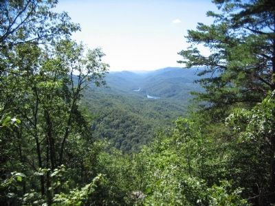
Photographed by Craig Swain, September 5, 2010
5. Tri-State Peak and Fern Lake
The peak on the ridge line in the foreground is the point where the three state boundaries intersect.
Credits. This page was last revised on August 30, 2022. It was originally submitted on September 19, 2010, by Craig Swain of Leesburg, Virginia. This page has been viewed 1,154 times since then and 36 times this year. Photos: 1. submitted on September 19, 2010, by Craig Swain of Leesburg, Virginia. 2. submitted on September 14, 2015, by Brandon Fletcher of Chattanooga, Tennessee. 3. submitted on September 19, 2010, by Craig Swain of Leesburg, Virginia. 4. submitted on August 30, 2022, by Tom Bosse of Jefferson City, Tennessee. 5. submitted on September 19, 2010, by Craig Swain of Leesburg, Virginia.
