West in McLennan County, Texas — The American South (West South Central)
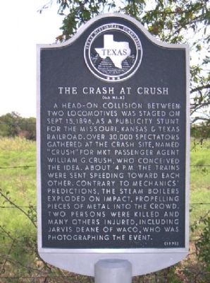
The Crash at Crush
(0.5 Mi. E)
Erected 1976 by Texas Historical Commission. (Marker Number 5315.)
Topics. This historical marker is listed in these topic lists: Entertainment • Railroads & Streetcars. A significant historical month for this entry is September 1803.
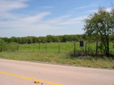
Location. 31° 44.816′ N, 97° 6.227′ W. Marker is in West, Texas, in McLennan County. Marker is on I-35, North-bound frontage road., 1.3 miles north of Farm to Market Road 3149, on the right when traveling north. Touch for map. Marker is in this post office area: West TX 76691, United States of America. Touch for directions.
Other nearby markers. At least 8 other markers are within 3 miles of this marker, measured as the crow flies. Groppe Barn (approx. 1.6 miles away); Former Site of St. Peter's Church (approx. 1.9 miles away); St. Mary's Cemetery (approx. 2.1 miles away); 36th Division Memorial (approx. 2.2 miles away); Milan Dujka (approx. 2.2 miles away); Ross (approx. 2.3 miles away); Bold Springs Cemetery (approx. 2.8 miles away); White Rock Cemetery (approx. 3.1 miles away). Touch for a list and map of all markers in West.
Also see . . . Article with photos of the crash at TexasEscapes. (Submitted on September 19, 2010, by Gregory Walker of La Grange, Texas.)
Additional commentary.
1. Potentially marker was moved from here to near Depot of West.
There is another "Crash at Crush" marker in the database (# 35909, see nearby markers). Potentially these two entries are the same as they share the same THC number (5315). Potentially the marker was moved from here near the crash site to the center of town near the Depot.
— Submitted August 4, 2016, by J. Makali Bruton of Accra, Ghana.
Credits. This page was last revised on September 14, 2020. It was originally submitted on September 19, 2010, by Gregory Walker of La Grange, Texas. This page has been viewed 12,171 times since then and 224 times this year. Photos: 1, 2. submitted on September 19, 2010, by Gregory Walker of La Grange, Texas. • Syd Whittle was the editor who published this page.

