Greenview in Columbia in Richland County, South Carolina — The American South (South Atlantic)
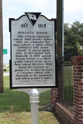
Monteith School
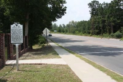
This African-American school, built nearby before 1900, was originally New Hope School, a white school affiliated with Union Church. It closed about 1914. In 1921 Rachel Hull Monteith (d. 1958) opened Nelson School as a black public school in the Hyatt Park School District. With about 100 students in grades 1-5, it later became a 3-teacher school with Monteith as its principal and added grades 6 and 7.
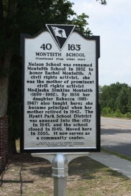
(Reverse text)
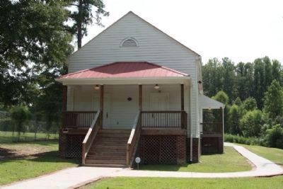
Nelson School was renamed Monteith School in 1932 to honor Rachel Monteith. A civil rights activist, she was the mother of prominent civil rights activist Modjeska Monteith Simkins (1899-1992). By 1936 her daughter Rebecca (1911-1967) also taught here; she became principal when her mother retired in 1942. The Hyatt Park School District was annexed into the city in 1947, and the school closed in 1949. Moved here in 2003, it now serves as a community center.
Erected 2009 by The Historic Columbia Foundation, the City of Columbia, and the S.C. Department of Transportation. (Marker Number 40-163.)
Topics. This historical marker is listed in these topic lists: African Americans • Education. A significant historical year for this entry is 1900.
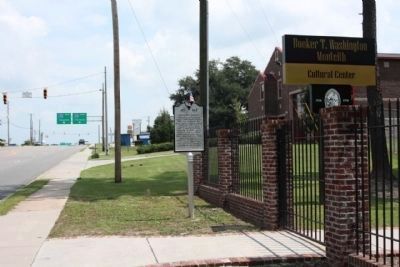
Location. 34° 4.143′ N, 81° 0.226′ W. Marker is in Columbia, South Carolina, in Richland County. It is in Greenview. Marker is on Main Street (U.S. 21), on the right when traveling north. Located between Mason Road and Wilkes Road. Touch for map. Marker is at or near this postal address: near 6510 Main Street, Columbia SC 29203, United States of America. Touch for directions.
Other nearby markers. At least 8 other markers are within 4 miles of this marker, measured as the crow flies. Zion Chapel Baptist Church No. 1 (approx. 2.2 miles away); Benjamin Mack House (approx. 2˝ miles away); I. DeQuincey Newman House (approx. 2.7 miles away); Camp Johnson (approx. 2.7 miles away); Dentsville School (approx. 2.9 miles away); South Carolina Female Collegiate Institute (approx. 2.9 miles away); Early Country Homes (approx. 3˝ miles away); Bethel Methodist Church (approx. 3.6 miles away). Touch for a list and map of all markers in Columbia.
Photographed By Mike Stroud, August 29, 2010
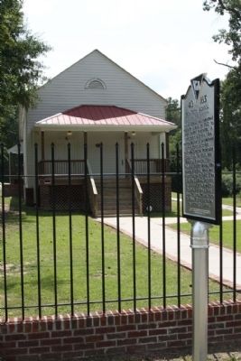
4. Monteith School
One of the few African-American schools remaining in the county, the restored building with hardwood floors and blackboards also will feature an outdoor classroom with planted cotton and corn, according to Henry Hopkins, director of the Eau Claire Community Council.
He is trying to raise funds for a heating and air conditioning system and other additions, including a wrought-iron fence and a walkway consisting of bricks from the original structure.(Free Times:Issue #21.38 :: 09/17/2008 - 09/23/2008)
Credits. This page was last revised on February 16, 2023. It was originally submitted on September 20, 2010, by Mike Stroud of Bluffton, South Carolina. This page has been viewed 1,007 times since then and 60 times this year. Photos: 1, 2, 3, 4, 5, 6. submitted on September 20, 2010, by Mike Stroud of Bluffton, South Carolina.
