Waverly in Sussex County, Virginia — The American South (Mid-Atlantic)
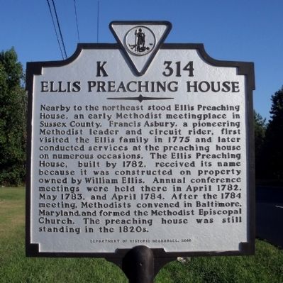
Ellis Preaching House
Erected 2000 by Department of Historic Resources. (Marker Number K-314.)
Topics and series. This historical marker is listed in this topic list: Churches & Religion. In addition, it is included in the Francis Asbury, Traveling Methodist Preacher, and the Virginia Department of Historic Resources (DHR) series lists. A significant historical month for this entry is April 1782.
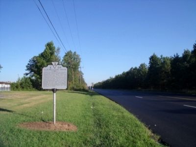
Location. 37° 0.948′ N, 77° 3.723′ W. Marker is in Waverly, Virginia, in Sussex County. Marker is at the intersection of South County Drive (U.S. 460) and Walnut Hill Road, on the right when traveling west on South County Drive. Touch for map . Marker is in this post office area: Waverly VA 23890, United States of America. Touch for directions.
Other nearby markers. At least 8 other markers are within 6 miles of this marker, measured as the crow flies. Early Peanut Crop (approx. 1.3 miles away); Miles B. Carpenter (approx. 2.3 miles away); Coppahaunk Springs (approx. 2.3 miles away); World War I Monument (approx. 2.4 miles away); World War II - Korea - Vietnam Memorial (approx. 2.4 miles away); Roadside Commerce (approx. 5 miles away); Wakefield Fountain Corner (approx. 5 miles away); Colonel Michael Blow (approx. 6 miles away). Touch for a list and map of all markers in Waverly.
Credits. This page was last revised on June 16, 2016. It was originally submitted on September 20, 2010, by Bernard Fisher of Richmond, Virginia. This page has been viewed 1,031 times since then and 53 times this year. Photos: 1, 2. submitted on September 20, 2010, by Bernard Fisher of Richmond, Virginia.

