Midlothian in Chesterfield County, Virginia — The American South (Mid-Atlantic)
Winfree Memorial Baptist Church - Midlothian Mine Disaster
Inscription.
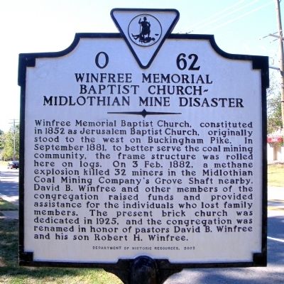
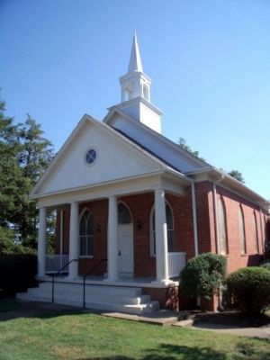
Winfree Memorial Baptist Church, constituted in 1852 as Jerusalem Baptist Church, originally stood to the west on Buckingham Pike. In September 1881, to better serve the coal mining community, the frame structure was rolled here on logs. On 3 Feb. 1882, a methane explosion killed 32 miners in the Midlothian Coal Mining Company's Grove Shaft nearby. David B. Winfree and other members of the congregation raised funds and provided assistance for the individuals who lost family members. The present brick church was dedicated in 1925, and the congregation was renamed in honor of pastors David B. Winfree and his son Robert H. Winfree.
Erected 2002 by Department of Historic Resources. (Marker Number O-62.)
Topics and series. This historical marker is listed in these topic lists: Charity & Public Work • Churches & Religion. In addition, it is included in the Virginia Department of Historic Resources (DHR) series list. A significant historical month for this entry is September 1881.
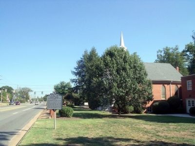
Location. 37° 30.225′ N, 77° 39.155′ W. Marker is in Midlothian, Virginia, in Chesterfield County. Marker is at the intersection of Midlothian Turnpike (U.S. 60) and Coalfield Road (Virginia Route 754), on the right when traveling east on Midlothian Turnpike. Touch for map. Marker is at or near this postal address: 13617 Midlothian Turnpike, Midlothian VA 23113, United States of America. Touch for directions.
Other nearby markers. At least 8 other markers are within walking distance of this marker. Midlothian Elementary School (approx. ¼ mile away); Union Raid On Coalfield Station (approx. 0.3 miles away); Salisbury (approx. 0.3 miles away); Midlothian Coal Mines (approx. 0.3 miles away); From Mines to Market (approx. ¾ mile away); Headstock (approx. ¾ mile away); The Bermuda Hundred Campaign (approx. ¾ mile away); Mid-Lothian Mines and Rail Roads (approx. 0.8 miles away). Touch for a list and map of all markers in Midlothian.
Also see . . .
1. Winfree Memorial Baptist Church. (Submitted on September 21, 2010, by Bernard Fisher of Richmond, Virginia.)
2. Mid-Lothian Mines & Rail Roads Foundation. (Submitted on September 21, 2010, by Bernard Fisher of Richmond, Virginia.)
Credits. This page was last revised on January 13, 2022. It was originally submitted on September 21, 2010, by Bernard Fisher of Richmond, Virginia. This page has been viewed 1,733 times since then and 92 times this year. Photos: 1, 2, 3. submitted on September 21, 2010, by Bernard Fisher of Richmond, Virginia.


