Midlothian in Chesterfield County, Virginia — The American South (Mid-Atlantic)
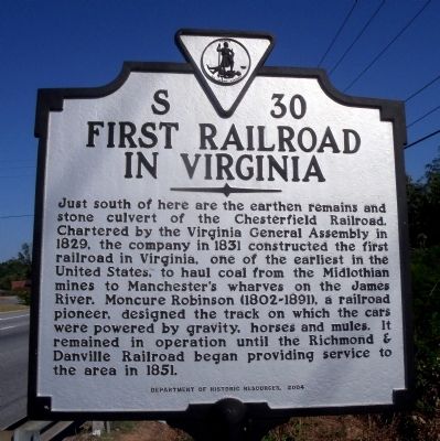
First Railroad in Virginia
Erected 2004 by Department of Historic Resources. (Marker Number S-30.)
Topics and series. This historical marker is listed in this topic list: Railroads & Streetcars. In addition, it is included in the Virginia Department of Historic Resources (DHR) series list. A significant historical year for this entry is 1829.
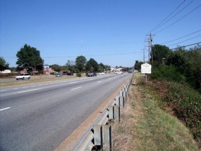
Location. 37° 30.41′ N, 77° 35.376′ W. Marker is in Midlothian, Virginia, in Chesterfield County. Marker is on Midlothian Turnpike (U.S. 60) 0.2 miles east of Johnston Willis Drive, on the right when traveling east. Touch for map. Marker is in this post office area: Richmond VA 23235, United States of America. Touch for directions.
Other nearby markers. At least 8 other markers are within 3 miles of this marker, measured as the crow flies. Bethlehem Baptist Church (approx. 0.9 miles away); Black Heath (approx. 1.4 miles away); Huguenot Settlement (approx. 1˝ miles away); Trabue's Tavern (approx. 1.8 miles away); Providence United Methodist Church (approx. 2.7 miles away); Mid-Lothian Mines and Rail Roads (approx. 3 miles away); The Bermuda Hundred Campaign (approx. 3 miles away); From Mines to Market (approx. 3 miles away). Touch for a list and map of all markers in Midlothian.
Also see . . . Mid-Lothian Mines & Rail Roads Foundation. (Submitted on September 21, 2010, by Bernard Fisher of Richmond, Virginia.)
Credits. This page was last revised on June 16, 2016. It was originally submitted on September 21, 2010, by Bernard Fisher of Richmond, Virginia. This page has been viewed 1,409 times since then and 70 times this year. Photos: 1, 2. submitted on September 21, 2010, by Bernard Fisher of Richmond, Virginia.

