Tate Springs in Lynchburg, Virginia — The American South (Mid-Atlantic)
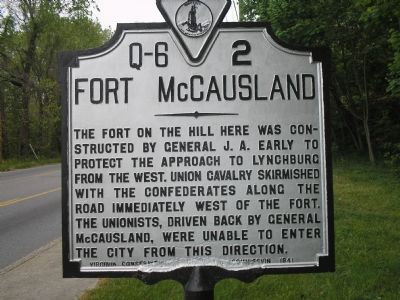
Fort McCausland
Erected 1941 by Virginia Conservtion Commission. (Marker Number Q-6-2.)
Topics and series. This historical marker is listed in these topic lists: Forts and Castles • War, US Civil. In addition, it is included in the Virginia Department of Historic Resources (DHR) series list.
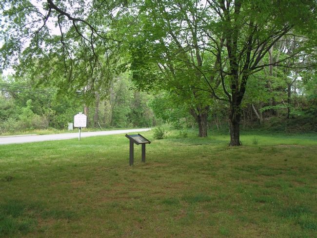
Location. 37° 24.806′ N, 79° 11.046′ W. Marker is in Lynchburg, Virginia. It is in Tate Springs. Marker is on Langhorne Road (U.S. 501), on the left when traveling west. Marker is on located in front of Agudath Sholom Synagogue, on Langhorne Road. Touch for map. Marker is at or near this postal address: 2055 Langhorne Road, Lynchburg VA 24501, United States of America. Touch for directions.
Other nearby markers. At least 8 other markers are within 2 miles of this marker, measured as the crow flies. A different marker also named Fort McCausland (a few steps from this marker); Lynchburg College (approx. 0.8 miles away); Locust Thicket (approx. one mile away); Civil War in Lynchburg (approx. 1.1 miles away); Lucille Chaffin Kent (approx. 1.1 miles away); Edward Christian Glass (1852-1931) (approx. 1.1 miles away); Memorial Avenue (approx. 1.1 miles away); Mustered and Disbanded 1861-1865 (approx. 1.3 miles away). Touch for a list and map of all markers in Lynchburg.
Regarding Fort McCausland. This is one in a series of Civil War Trails markers interpreting the Battle of Lynchburg (17-18 June 1864) and the city's role in the Civil War. Select the Civil War Virtual Tour by Marker link below to see other related markers.
Also see . . . Civil War Lynchburg Virtual Tour by Markers. An eight stop Civil War Trails tour, with several Virginia state markers and other memorials added. (Submitted on December 8, 2007, by Craig Swain of Leesburg, Virginia.)
Credits. This page was last revised on February 1, 2023. It was originally submitted on November 17, 2007, by Bill Coughlin of Woodland Park, New Jersey. This page has been viewed 1,707 times since then and 22 times this year. Photos: 1, 2. submitted on November 17, 2007, by Bill Coughlin of Woodland Park, New Jersey. 3. submitted on March 20, 2021, by Bradley Owen of Morgantown, West Virginia. • J. J. Prats was the editor who published this page.


