Miller Park in Lynchburg, Virginia — The American South (Mid-Atlantic)
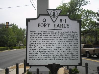
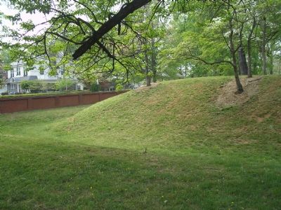
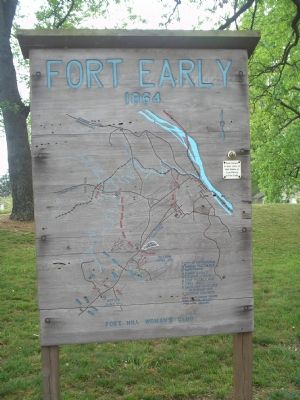
Fort Early
Erected 2002 by Department of Historic Resources. (Marker Number Q–6-1.)
Topics and series. This historical marker is listed in this topic list: War, US Civil. In addition, it is included in the Virginia Department of Historic Resources (DHR) series list. A significant historical month for this entry is June 1864.
Location. 37° 23.403′ N, 79° 10.359′ W. Marker is in Lynchburg, Virginia. It is in Miller Park. Marker is at the intersection of Fort Avenue (Business U.S. 460) and Memorial Ave (Business U.S. 29), on the right when traveling north on Fort Avenue. Touch for map. Marker is in this post office area: Lynchburg VA 24501, United States of America. Touch for directions.
Other nearby markers. At least 8 other markers are within one mile of this marker, measured as the crow flies. Jubal Early Memorial (here, next to this marker); Battle of Lynchburg Memorial Arch (within shouting distance of this marker); This Reservation (within shouting distance of this marker); Lynchburg During The Civil War (within shouting distance of this marker); a different marker also named Fort Early (about 300 feet away, measured in a direct line); Spring Hill Cemetery (approx. 0.6 miles away); Lynchburg College (approx. one mile away); Memorial Avenue (approx. one mile away). Touch for a list and map of all markers in Lynchburg.
Regarding Fort Early. This is one in a series of Civil War Trails markers interpreting the Battle of Lynchburg (17-18 June 1864) and the city's role in the Civil War. Select the Civil War Virtual Tour by Marker link below to see other related markers.
Also see . . . Civil War Lynchburg Virtual Tour by Markers. An eight stop Civil War Trails tour, with several Virginia state markers and other memorials added. (Submitted on December 8, 2007, by Craig Swain of Leesburg, Virginia.)
Credits. This page was last revised on February 1, 2023. It was originally submitted on November 17, 2007, by Bill Coughlin of Woodland Park, New Jersey. This page has been viewed 1,931 times since then and 46 times this year. Photos: 1, 2, 3. submitted on November 17, 2007, by Bill Coughlin of Woodland Park, New Jersey. • J. J. Prats was the editor who published this page.


