Fort Scott in Bourbon County, Kansas — The American Midwest (Upper Plains)
Civil War Town
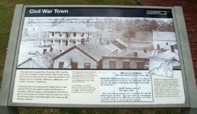
"If you have reinforcements...send them forward. The point to defend Fort Leavenworth is in the neighborhood of Fort Scott."
General Jim Lane to the commander of Fort Leavenworth, 1861
The army had vacated Fort Scott in 1853, but the Civil War brought it back in force. The Union used the Fort Scott area to recruit and train soldiers and supply forces in Kansas, Missouri, Arkansas, and Indian Territory (Oklahoma).
Union facilities encompassed a large area in and around Fort Scott, and included warehouses, a hospital, military prison, and cemetery. Fort Scott gave vital support to Union victories that prevented Confederate raids and campaigns elsewhere in the Western theater.
[Photo captions read]
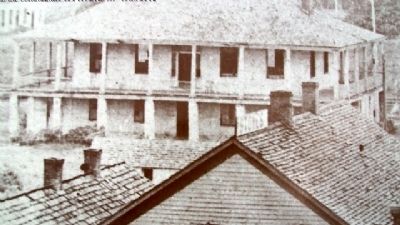
The original post hospital (building with large porch) and guardhouse (far right) appear in this 1860s photo, taken shortly after the Civil War. During the war the Union leased these buildings and many others from the "old" fort.
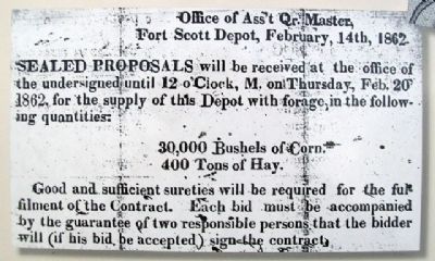
The magnitude of the army's presence at Fort Scott during the Civil War is illustrated by this 1862 ad (right), which the army used to procure feed for its animals.
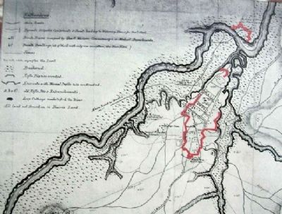
In 1863 Union officers mapped their positions around Fort Scott (above). Lieutenant Charles Porter indicated the extent of Union positions in his October 1863 report: "This morning I was detailed as Officer of the Picket. My duty was to ride out to each station and learn the condition and reports from them....At dark I had made the circuit of 40 miles and was then 7 miles from the Fort."
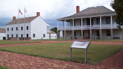
Erected 1998 by National Park Service.
Topics and series. This historical marker is listed in these topic lists: Forts and Castles • Settlements & Settlers • War, US Civil. In addition, it is included in the Fort Scott, Kansas series list. A significant historical month for this entry is October 1863.
Location. 37° 50.573′ N, 94° 42.326′ W. Marker is in Fort Scott, Kansas, in Bourbon County. Marker can be reached from Old Fort Boulevard. Marker is on the grounds of Fort Scott National Historic Site. Touch for map. Marker is in this post office area: Fort Scott KS 66701, United States of America. Touch for directions.
Other nearby markers. At least 8 other markers are within walking distance of this marker. Fort Scott Yesterday (a few steps from this marker); Fort Gardens (a few steps from this marker); The Sites and People of Fort Scott (within shouting distance of this marker); Gordon Parks (within shouting distance of this marker); Fort Scott (within shouting distance of this marker); Sutler Store (within shouting distance of this marker); Medal of Honor
(within shouting distance of this marker); The Heart of Fort Scott (within shouting distance of this marker). Touch for a list and map of all markers in Fort Scott.
Credits. This page was last revised on July 7, 2020. It was originally submitted on September 29, 2010, by William Fischer, Jr. of Scranton, Pennsylvania. This page has been viewed 993 times since then and 9 times this year. Photos: 1, 2, 3, 4, 5. submitted on September 29, 2010, by William Fischer, Jr. of Scranton, Pennsylvania.
