Fort Scott in Bourbon County, Kansas — The American Midwest (Upper Plains)
The Heart of Fort Scott
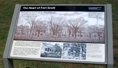
"Fort Scott can boast of the handsomest Square in Kansas Territory."
Fort Scott Democrat, praising the town plaza, April 5, 1860
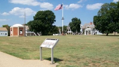
The grassy square in front of you silently witnessed events that defined Fort Scott and that reflected a growing nation. Built originally as the fort's parade ground, this square truly is the heart of Fort Scott.
When the army sold Fort Scott in 1855, the parade ground became a town park called Carroll Plaza. Through the years this ground hosted military pomp, music, laughter, civic pride, political strife, violence, and suffering - events and emotions symbolic of a young America.
[Photo captions read]
The basic, historic look of the parade ground is seen in this circa-1900 postcard view. Notice all four officers' quarters, and that the well canopy and powder magazine are gone. A bandstand occupies the site where the post flagpole once stood.
—————
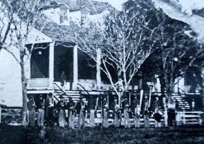
A military band practices on the plaza (far left) during the Civil War. In 1862 the Fort Scott Bulletin observed, "The Brass Bands of the 2nd Ohio Cavalry and 9th Wisconsin Infantry, daily discourse the best music, from Carroll Plaza. They are both good bands, and will be much missed when they leave us.
—————
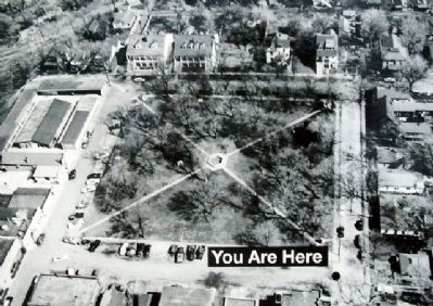
Through the years the plaza survived intact, even though the town grew to its edges (1960s photo, near left).
Erected 1998 by National Park Service.
Topics and series. This historical marker is listed in these topic lists: Forts and Castles • Settlements & Settlers • War, US Civil. In addition, it is included in the Fort Scott, Kansas series list. A significant historical date for this entry is April 5, 1924.
Location. 37° 50.582′ N, 94° 42.283′ W. Marker is in Fort Scott, Kansas, in Bourbon County. Marker can be reached from Old Fort Boulevard. Marker is on the grounds of Fort Scott National Historic Site. Touch for map. Marker is in this post office area: Fort Scott KS 66701, United States of America. Touch for directions.
Other nearby markers. At least 8 other markers are within walking distance of this marker. Fort Gardens (within shouting distance of this marker); Infantry Life (within shouting distance of this marker); Civil War Town (within shouting distance of this marker); "A Most Deplorable Condition" (within shouting distance of this marker); Fort Scott Yesterday (within shouting distance of this marker); Free to Learn (within shouting distance of this marker); "The Crack Post of the Frontier" (within shouting distance of this marker); Western Hotel: Symbol of Strife (about 300 feet away, measured in a direct line). Touch for a list and map of all markers in Fort Scott.
Also see . . .
1. Fort Scott National Historic Site. Nation Park Service website homepage (Submitted on September 26, 2010, by William Fischer, Jr. of Scranton, Pennsylvania.)
2. Fort Scott National Historic Structures Report. National Park Service website entry (Submitted on September 26, 2010, by William Fischer, Jr. of Scranton, Pennsylvania.)
Credits. This page was last revised on December 5, 2021. It was originally submitted on September 26, 2010, by William Fischer, Jr. of Scranton, Pennsylvania. This page has been viewed 1,096 times since then and 10 times this year. Last updated on September 29, 2010, by Richard E. Miller of Oxon Hill, Maryland. Photos: 1, 2, 3, 4. submitted on September 26, 2010, by William Fischer, Jr. of Scranton, Pennsylvania. • Craig Swain was the editor who published this page.


