Near Pittstown in Hunterdon County, New Jersey — The American Northeast (Mid-Atlantic)
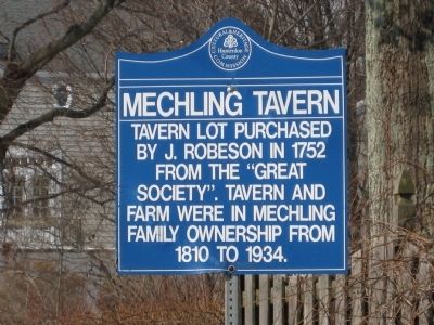
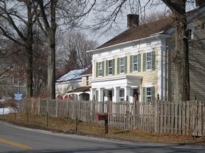
Mechlin's Tavern
Erected by Hunterdon County Cultural and Heritage Commission.
Topics and series. This historical marker is listed in these topic lists: Colonial Era • Industry & Commerce. In addition, it is included in the New Jersey, Hunterdon County Cultural and Heritage Commission series list. A significant historical year for this entry is 1752.
Location. 40° 36.649′ N, 74° 59.286′ W. Marker is near Pittstown, New Jersey, in Hunterdon County. Marker is at the intersection of Mechlin Corner Road (County Route 579 at milepost 30.4) and Bloomsbury Road (County Route 625), on the right when traveling west on Mechlin Corner Road. Touch for map. Marker is at or near this postal address: 701 Mechlin Corner Rd, Pittstown NJ 08867, United States of America. Touch for directions.
Other nearby markers. At least 8 other markers are within 3 miles of this marker, measured as the crow flies. Mount Salem Church (approx. half a mile away); Worthington Farm (approx. 1.3 miles away); Lieutenant Hooper Road (approx. 1.4 miles away); Union Township World War II Memorial (approx. 1.7 miles away); Perryville Tavern (approx. 1.8 miles away); Taylor Farm (approx. 1.9 miles away); Pattenburg United Methodist Church (approx. 2.1 miles away); Bethlehem Baptist Church (approx. 2.2 miles away). Touch for a list and map of all markers in Pittstown.
Credits. This page was last revised on December 28, 2020. It was originally submitted on March 1, 2009, by Alan Edelson of Union Twsp., New Jersey. This page has been viewed 1,782 times since then and 35 times this year. Last updated on October 1, 2010, by John Ben Urban of Middletown, Delaware. Photos: 1, 2. submitted on March 1, 2009, by Alan Edelson of Union Twsp., New Jersey. • Bill Pfingsten was the editor who published this page.

