Gloucester in Essex County, Massachusetts — The American Northeast (New England)
Revolutionary War Memorial
Photographed by Michael Herrick, September 26, 2010
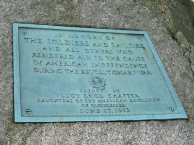
1. Revolutionary War Memorial
In memory of the soldiers and sailors and all others who rendered aid to the cause of American Independence during the Revolutionary War
Erected by Lucy Knox Chapter Daughters of the American Revolution of Gloucester
June 17, 1913
Erected 1913 by Lucy Knox Chapter Daughters of the American Revolution (DAR).
Topics and series. This historical marker and memorial is listed in this topic list: War, US Revolutionary. In addition, it is included in the Daughters of the American Revolution (DAR) series list. A significant historical month for this entry is June 1625.
Location. 42° 36.318′ N, 70° 40.589′ W. Marker is in Gloucester, Massachusetts, in Essex County. It can be reached from the intersection of Western Avenue (Massachusetts Route 127) and Essex Avenue ( Route 133), on the right when traveling north. Located in Stage Fort Park. Touch for map. Marker is in this post office area: Gloucester MA 01930, United States of America. Touch for directions.

Regionally, this marker and memorial is on Cape Ann, on the North Shore, in Greater Boston, and in the Merrimack Valley. It is also in the American Northeast, in New
this page online
Other nearby markers. At least 8 other markers are within walking distance of this marker: Stage Fort Fisherman's Field (here, next to this marker); First House (about 600 feet away, measured in a direct line); Cape Ann Settlement (about 600 feet away); Settlement of Cape Ann (about 600 feet away); Nathaniel Warner Company Monument (about 700 feet away); Gloucester World War II Merchant Marine Monument (approx. ¼ mile away); In Honor of Nathaniel Haraden (approx. ¼ mile away); Gloucester World War II Monument (approx. ¼ mile away). Touch for a list and map of all markers in Gloucester.

Photographed by Michael Herrick, September 26, 2010
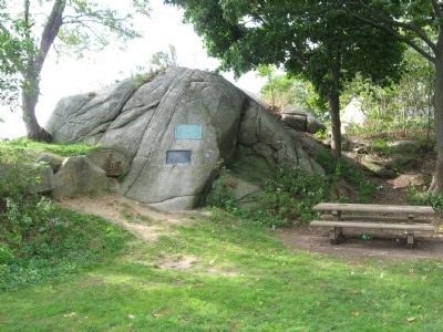
2. Revolutionary War Memorial
Beneath this memorial is the Stage Fort Fisherman's Field marker.
Photographed by Michael Herrick, September 26, 2010
3. Revolutionary War Memorial
Credits. This page was last revised on May 19, 2023. It was originally submitted on October 1, 2010, by Michael Herrick of Southbury, Connecticut. This page has been viewed 1,750 times since then and 41 times this year. Photos: 1, 2, 3. submitted on October 1, 2010, by Michael Herrick of Southbury, Connecticut.
