Clifton in Greenlee County, Arizona — The American Mountains (Southwest)
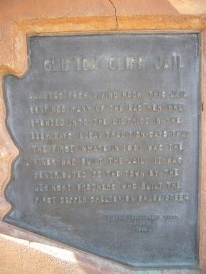
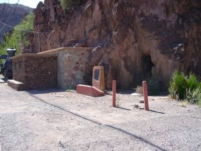
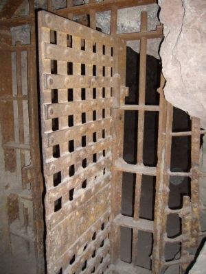
Clifton Cliff Jail
Erected 1962 by Arizona Development Board.
Topics. This historical marker is listed in this topic list: Law Enforcement. A significant historical year for this entry is 1881.
Location. 33° 3.33′ N, 109° 17.958′ W. Marker is in Clifton, Arizona, in Greenlee County. Marker is on The Coronado Trail (U.S. 191 at milepost 164), on the left when traveling north. Touch for map. Marker is in this post office area: Clifton AZ 85533, United States of America. Touch for directions.
Other nearby markers. At least 8 other markers are within 15 miles of this marker, measured as the crow flies. Town of Clifton (about 500 feet away, measured in a direct line); The Eagles' Hall (approx. 0.3 miles away); Fermin Palicio Home (approx. 0.3 miles away); Phelps Dodge Hidalgo Smelter (approx. 0.3 miles away); San Francisco River (approx. half a mile away); Black Hills National Back Country Byway (approx. 3.7 miles away); Jose (Joe) M. Subia Memorial Bridge (approx. 6.2 miles away); Apache Grove (approx. 14.3 miles away). Touch for a list and map of all markers in Clifton.
Also see . . . The Clifton Cliff Jail. A short Arizona Stories-Milestones AzPBS.org (KATV-8) video production by Arizona State University with photos and information on the jail. (Submitted on September 29, 2010.)
Additional keywords. jails
Credits. This page was last revised on August 29, 2020. It was originally submitted on September 28, 2010, by Bill Kirchner of Tucson, Arizona. This page has been viewed 1,580 times since then and 52 times this year. Last updated on October 1, 2010, by Bill Kirchner of Tucson, Arizona. Photos: 1, 2, 3. submitted on September 28, 2010, by Bill Kirchner of Tucson, Arizona. • Syd Whittle was the editor who published this page.


