Eagar in Apache County, Arizona — The American Mountains (Southwest)
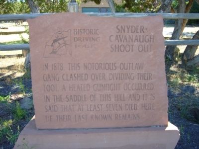
Snyder-Cavanaugh Shoot Out
Erected 2002 by Round Valley Positive Action Tourism Committee and Springerville-Eagar Chamber of Commerce. (Marker Number 6.)
Topics and series. This historical marker is listed in this topic list: Cemeteries & Burial Sites. In addition, it is included in the Arizona, Pistols, Plows and Petticoats Historic Driving Tour series list. A significant historical year for this entry is 1878.
Location. 34° 6.52′ N, 109° 18.278′ W. Marker is in Eagar, Arizona, in Apache County. Marker is on South River Road, 0.1 miles south of West Central Avenue, on the left when traveling south. Touch for map. Marker is in this post office area: Eagar AZ 85925, United States of America. Touch for directions.
Other nearby markers. At least 8 other markers are within one mile of this marker, measured as the crow flies. Old Grist Mill Site (approx. half a mile away); Eagar Elementary School (approx. ¾ mile away); Oscar Jepson Home (approx. 0.8 miles away); Joseph Udall Barn (approx. 0.8 miles away); Harry Colter Home (approx. 0.9 miles away); Benjamin B. Crosby Home (approx. 0.9 miles away); William LeSueur Home (approx. 0.9 miles away); Rencher Home (approx. one mile away). Touch for a list and map of all markers in Eagar.
More about this marker. This is Marker Stop #6 on the Pistols, Plows and Petticoats Historic Driving Tour.
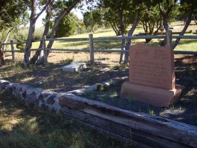
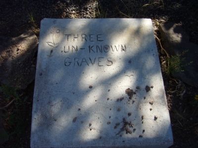
Regarding Snyder-Cavanaugh Shoot Out. A stone slab next to the marker marks the location of the last known remains of the Snyder-Cavanaugh Gang, a notorious band of outlaws who came into the Little Colorado River country in 1878. They robbed and killed up and down the river and prompted Don Lorenzo Hubbell, the famous Indian trader to the Navajos, who then had a store in St. Johns, to buy guns and ammunition and arm the residents of St. Johns.
Led by Bill Cavanaugh, who also went by the alias of Snyder, the gang had a falling out over $12,000 in gold they had taken from a German whom they had robbed and killed. A gunfight erupted among them here that killed several gang members and left Cavanaugh-Snyder badly wounded. The remainder of the gang traveled down the river to St. Johns and got into a battle with Hubbell and the armed St. Johns residents and several more were killed. Upon their return to Springerville they again met with resistance from the locals and the rest of the gang was killed. It is said that seven to nine gang members were buried on the hill overlooking the Eagar Sawmill, however when dirt was removed for the building of State Route 73 only the remains of three were found. These remains were relocated to this site and marked with this stone.
Source: The Pistols, Plows and Petticoats Historic Driving Tour Brochure.
Credits. This page was last revised on June 16, 2016. It was originally submitted on October 5, 2010, by Bill Kirchner of Tucson, Arizona. This page has been viewed 2,173 times since then and 67 times this year. Photos: 1, 2, 3. submitted on October 5, 2010, by Bill Kirchner of Tucson, Arizona. • Syd Whittle was the editor who published this page.


