
Mount Pleasant in Charleston County, South Carolina — The American South (South Atlantic)
Darby Building
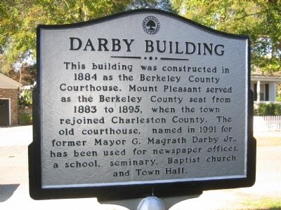
1. Darby Building Marker
Topics. This historical marker is listed in this topic list: Government & Politics. A significant historical year for this entry is 1884.
Location. 32° 47.135′ N, 79° 52.461′ W. Marker is in Mount Pleasant, South Carolina, in Charleston County. It is at the intersection of King Street and Carr Street, on the right when traveling north on King Street. Touch for map. Marker is in this post office area: Mount Pleasant SC 29464, United States of America. Touch for directions.

Regionally, this marker is in the Lowcountry. It is also in the American South, specifically in the Deep South, and on the Eastern Seaboard. Globally, it is in the North Atlantic Region, North America, the Western Hemisphere, the Western World, and the Anglosphere. Historically, it finds itself
this page online
Other nearby markers. At least 8 other markers are within walking distance of this marker: War of 1812 Encampment (within shouting distance of this marker); Confederate Cemetery / Memorial (within shouting distance of this marker); Laing School (about 400 feet away, measured in a direct line); Friendship A.M.E. Church (about 400 feet away); Patjens Post Office (about 400 feet away); "Storm of the Century" (about 600 feet away); Ronkin's Long Room / Ferry Service (about 600 feet away); The Old Village (approx. 0.2 miles away). Touch for a list and map of all markers in Mount Pleasant.
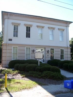
October 6, 2010
2. Darby Building & Marker
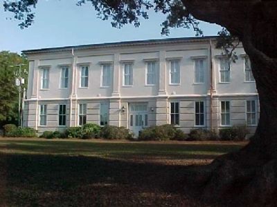
3. Darby Building
Credits. This page was last revised on May 22, 2020. It was originally submitted on October 7, 2010. This page has been viewed 720 times since then and 28 times this year. Photos: 1, 2, 3. submitted on October 7, 2010. • Craig Swain was the editor who published this page.
