Marker Logo
THE HISTORICAL
MARKER DATABASE
“Bite-Size Bits of Local, National, and Global History”
Mount Pleasant in Charleston County, South Carolina — The American South (South Atlantic)
 

Etiwan Masonic Lodge
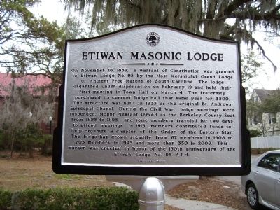
 
 
Etiwan Masonic Lodge Marker image. Click for full size.
December 30, 2026
1. Etiwan Masonic Lodge Marker
Inscription. On November 18, 1859, a Warrant of Constitution was granted to Etiwan Lodge No. 95 by the Most Worshipful Grand Lodge of Ancient Free Masons of South Carolina. The lodge organized under dispensation on February 19 and held their first meeting in Town Hall on March 4. The fraternity purchased its current lodge hall that same year for $500. The structure was built in 1835 as the original St. Andrews Episcopal Chapel. During the Civil War, lodge meetings were suspended. Mount Pleasant served as the Berkeley County Seat from 1885 to 1895, and some members traveled for two days to attend meetings. In 1913, members contributed funds to help organize a chapter of the Order of the Eastern Star. The lodge has grown steadily from 67 members in 1908 to 203 members in 1945 and more than 350 in 2009. This marker was erected in honor of the 150th anniversary of the Etiwan Lodge No. 95 A.F.M.
 
Erected 2009 by Etiwan Lodge No. 95 A.F.M.
 
Topics. This historical marker is listed in this topic list: Fraternal or Sororal Organizations. A significant historical month for this entry is February 1884.
 
Location. 32° 47.299′ N, 79° 52.556′ W. Marker is
Paid Advertisement
Click or scan to see
this page online
in Mount Pleasant, South Carolina, in Charleston County. It is at the intersection of Whilden Street and Rose Lane, on the right when traveling north on Whilden Street. Touch for map. Marker is in this post office area: Mount Pleasant SC 29464, United States of America. Touch for directions.

Regionally, this marker is in the Lowcountry. It is also in the American South and specifically in the Deep South. Globally, it is in the North Atlantic Region, North America, the Western Hemisphere, the Western World, and the Anglosphere. Historically, it finds itself in what was once the territory of the Mississippian Culture, one of the original Thirteen Colonies, one of the Confederate States of America, and the Antebellum South.

Other nearby markers. At least 8 other markers are within walking distance of this marker: St. Andrew's Church (here, next to this marker); Pitt Street Merchants (about 400 feet away, measured in a direct line); The Whilden House / 54th Massachusetts Regiment (about 700 feet away); Mount Pleasant Home for Destitute Children (about 800 feet away); Mount Pleasant Presbyterian Church (about 800 feet away);
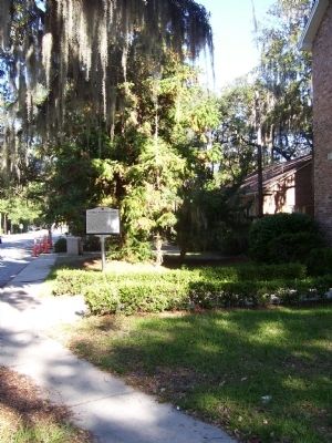
Etiwan Masonic Lodge Marker image. Click for full size.
October 6, 2010
2. Etiwan Masonic Lodge Marker
Laing School (approx. 0.2 miles away); "The Kings Highway" (approx. 0.2 miles away); Darby Building (approx. 0.2 miles away). Touch for a list and map of all markers in Mount Pleasant.
 
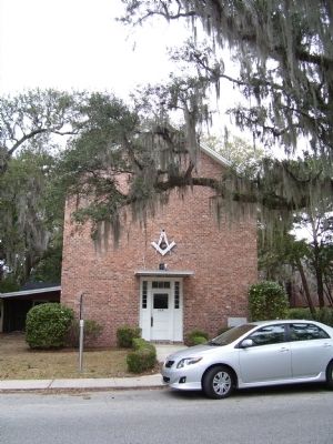
Etiwan Lodge image. Click for full size.
December 30, 2026
3. Etiwan Lodge
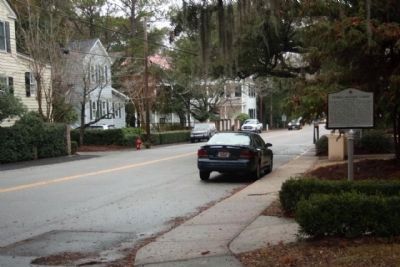
Etiwan Masonic Lodge Marker, looking north along Whilden Street image. Click for full size.
Photographed by Mike Stroud, January 2011
4. Etiwan Masonic Lodge Marker, looking north along Whilden Street
 
 
Credits. This page was last revised on May 22, 2020. It was originally submitted on October 7, 2010. This page has been viewed 779 times since then and 14 times this year. Photos:   1, 2, 3. submitted on October 7, 2010.   4. submitted on January 6, 2011, by Mike Stroud of Bluffton, South Carolina. • Craig Swain was the editor who published this page.

m=36684

CeraNet Cloud Computing sponsors the Historical Marker Database.
This website earns income from purchases you make after using our links to Amazon.com. We appreciate your support.
Paid Advertisement
Jul. 17, 2026