Fort Payne in DeKalb County, Alabama — The American South (East South Central)
Cherokee Indian Removal
Photographed by Tim & Renda Carr, May 31, 2010
1. Cherokee Indian Removal Marker
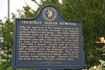
Under the provisions of the Cherokee Removal Act of 1830, a log stockade was built, “Two hundred yards Northeast of Big Spring.” The spring supplied abundant water for the Cherokees, the soldiers and livestock. Fort Payne was used as both an interment camp and a removal fort. It was built by Capt. James H. Rogers on a site chosen by Capt. John G. Payne. Rogers and 22 soldiers began construction of the fort on April 13, 1838 and remained until the departure of the last group of Cherokees on October 3rd. This group of 1,103 was conducted to Indian Territory by Cherokee leader John Benge. Alabama remains the home of many Cherokee Indians today.
Erected 1998 by The Alabama Indian Affairs Commission.
Topics and series. This historical marker is listed in this topic list: Indigenous Peoples and Communities. In addition, it is included in the Trail of Tears series list. A significant historical date for this entry is April 13, 1838.
Location. 34° 26.345′ N, 85° 43.333′ W. Marker is in Fort Payne, Alabama, in DeKalb County. It is at the intersection of Godfrey Avenue and Logan Street Southeast, on the right when traveling
this page online

Regionally, this marker is in North Alabama. It is also in the American South, specifically in the Deep South, in Appalachia, and specifically in Southern Appalachia. Globally, it is in North America, a Gulf of Mexico state, the Western Hemisphere, the Western World, and the Anglosphere. Historically, it finds itself in what was once the original Cherokee Nation, the territory of the Mississippian Culture, one of the Confederate States of America, and the Antebellum South.
Other nearby markers. At least 8 other markers are within walking distance of this marker: Main Street Historic District (about 600 feet away, measured in a direct line); Fort Payne Cabin Historic Site (about 600 feet away); Fort Payne Residential Historic District (approx. ¼ mile away); Alabama (approx. 0.3 miles away); Whittler's Corner (approx. 0.3 miles away); Confederate Monument (approx. 0.4 miles away); Fort Payne Opera House (approx. 0.4 miles away); Sequoyah | Socks | Song | Scenery (approx. 0.4
Photographed by Tim & Renda Carr, May 31, 2010
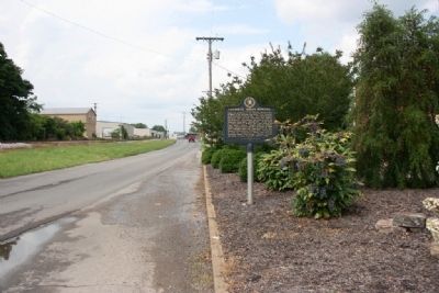
2. Cherokee Indian Removal Marker (North View)
Other markers no longer nearby. Sequoyah (was approx. 0.3 miles away but has been confirmed missing); Wills Town Mission (was approx. 0.3 miles away but has been confirmed missing); Fort Payne’s Fort (was approx. 0.3 miles away but has been confirmed missing); Boom Town Historic District (was approx. 0.4 miles away but has been confirmed missing).
Also see . . . Trail of Tears. "History" entry (Submitted on January 2, 2017, by Byron Hooks of Sandy Springs, Georgia.)
Photographed by Tim & Renda Carr, May 31, 2010
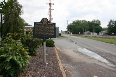
3. Cherokee Indian Removal Marker (South View)
Photographed by Tim & Renda Carr, May 31, 2010
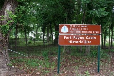
4. Fort Payne Cabin Historic Site
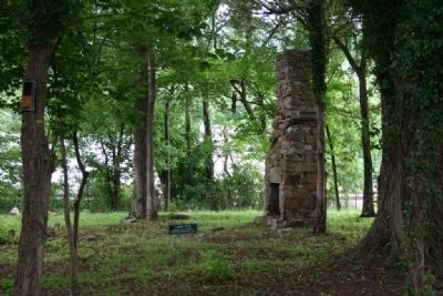
Photographed by Tim & Renda Carr, May 31, 2010
5. The Site of Fort Payne
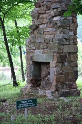
Photographed by Tim & Renda Carr, May 31, 2010
6. Site of Fort Payne

Photographed by Larry Gertner, April 22, 2021
7. "Unto These Hills" Outdoor Drama Retells the Trail of Tears in Cherokee, NC
Millions of visitors have attended Unto These Hills, presented by the Cherokee Historical Association, which tells the story of the Cherokees and the Trail of Tears.
Click for more information.
Click for more information.
Credits. This page was last revised on April 22, 2021. It was originally submitted on October 9, 2010, by Timothy Carr of Birmingham, Alabama. This page has been viewed 3,589 times since then and 130 times this year. Photos: 1, 2, 3, 4, 5, 6. submitted on October 9, 2010, by Timothy Carr of Birmingham, Alabama. 7. submitted on April 22, 2021, by Larry Gertner of New York, New York. • Craig Swain was the editor who published this page.
