Near Conway in Horry County, South Carolina — The American South (South Atlantic)
Coastal Carolina University
Photographed by Cindy Bullard, October 7, 2010
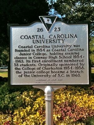
1. Coastal Carolina University Marker (front)
Coastal Carolina University was founded in 1954 as Coastal Carolina Junior College, holding evening classes in Conway High School 1954-1963. Its first enrollment numbered 53 students. Originally sponsored by the College of Charleston 1954-1958, the junior college became a branch of the University of S.C. in 1960.
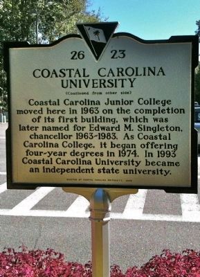
[Reverse]
Coastal Carolina Junior College moved here in 1963 on the completion of its first building, later named for Edward M. Singleton, chancellor 1963-1983. As Coastal Carolina College, it began offering four-year degrees in 1974. In 1993 Coastal Carolina University became an independent state university.
Erected 2009 by Coastal Carolina University. (Marker Number 26-23.)
Topics. This historical marker is listed in this topic list: Education. A significant historical year for this entry is 1954.
Location. 33° 47.607′ N, 79° 0.662′ W. Marker is near Conway, South Carolina, in Horry County. It is at the intersection of James P. Blanton Circle and College Boulevard (South Carolina Highway 26-953), in the median on James P. Blanton Circle. Marker is located on the university campus in James Blanton
this page online

Regionally, this marker is in South Carolina’s Pee Dee. It is also in the American South, specifically in the Deep South, and on the Eastern Seaboard. Globally, it is in the North Atlantic Region, North America, the Western Hemisphere, the Western World, and the Anglosphere. Historically, it finds itself in what was once the territory of the Mississippian Culture, one of the original Thirteen Colonies, one of the Confederate States of America, and the Antebellum South.
Other nearby markers. At least 8 other markers are within 4 miles of this marker, measured as the crow flies: Horry-Georgetown Tech (approx. 0.6 miles away); Grier’s/Cox’s Ferry (approx. 2.2 miles away); The Steamboat Era on the Waccamaw River (approx. 3.3 miles away); Waccamaw River Water Trail (approx. 3.3 miles away); High Water Mark Hurricane Florence (approx. 3.4 miles away); Centennial Time Capsule (approx. 3½ miles away); Old Horry County Courthouse (approx. 3½ miles away); Kingston Church (approx.
Photographed by Cindy Bullard, October 7, 2010
2. Coastal Carolina University Marker (reverse)
Another marker is no longer nearby. Kingston-Conway / Robert Conway (was approx. 3½ miles away but has been confirmed missing).
Photographed by Cindy Bullard, October 7, 2010
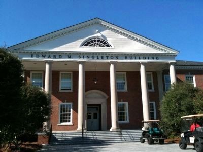
3. Edward M. Singleton Building
First building on the Coastal Carolina campus.
Photographed by Cindy Bullard, October 7, 2010
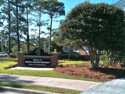
4. Sign in front of Edward M. Singleton Building
Credits. This page was last revised on June 16, 2016. It was originally submitted on October 10, 2010, by David Bullard of Seneca, South Carolina. This page has been viewed 1,635 times since then and 48 times this year. Photos: 1, 2, 3, 4. submitted on October 10, 2010, by David Bullard of Seneca, South Carolina. • Kevin W. was the editor who published this page.
